Old Maps of Notown, Stockbridge
Explore 15 old maps of Notown, spanning from 1911 to today. These high-resolution historic maps reveal how streets, neighborhoods, landmarks, and natural features evolved over time — perfect for genealogy, metal detecting, research, and local history exploration.
What you can do with these maps:
- See how Notown changed over time: Compare historical maps to modern-day views to trace roads, homesites, rail lines & more.
- View detailed metadata: Each map includes creators, publishers, year, scale, and archive source.
- Overlay maps with satellite & LiDAR: Visualize the past alongside modern tools to explore terrain & human change.
- Trusted historical sources: Maps sourced from the USGS, Library of Congress, and other archives.
- Access maps your way: View online, download high-res files, or order prints for personal or research use.
Start exploring old maps of Notown to uncover forgotten places, hidden landmarks, and the deep history beneath your feet.
Notown, Stockbridge maps
(15)- 1911 Map of Woodstock, 1958 Print
 1911 Woodstock1958 Print · USGSWindsor County villages and mountain hollows are captured here at the dawn of the twentieth century. Researchers can trace the early path of the Woodstock Railroad or locate family sites near the Town Farm and Plymouth Notch.
 - 1913 Map of Woodstock
 1913 Woodstock1913 Print · USGSWindsor County villages and narrow valley settlements are captured here in the decade before the First World War. Genealogists can trace family lines through numerous rural schoolhouses like Mendall School and early post offices at Bridgewater Center Briggs P O.5 unique versions available
 - 1943 Map of Woodstock
 1943 Woodstock1943 Print · USGSWindsor County's high country and river valleys are captured here during the early 1940s, showing a landscape of small hill farms and rural schools. Researchers can locate many former community hubs like English Mills, the Town Farm, and Notown.
 - 1950 Map of Glens Falls
 1950 Glens Falls1950 Print · USGSThe Adirondacks and the Green Mountains meet in this mid-century survey of the New York and Vermont borderlands. Researchers can trace the industrial rail corridors of the Rutland RR and Delaware & Hudson RR connecting Glens Falls, Rutland, and the shores of Lake George.
 - 1956 Map of Glens Falls, 1968 Print
 1956 Glens Falls1968 Print · USGSUpper New York and the Vermont mountains are captured here in the mid-fifties, showing the rugged rail-and-river network of the Northeast. Researchers can trace the paths of the Delaware and Hudson RR and Rutland RR as they wind through valley towns like Poultney and Whitehall.3 unique versions available
 - 1959 Map of Glens Falls
 1959 Glens Falls1959 Print · USGSUpper New York and Vermont are captured here during the late 1950s, a period of transition for these mountain communities. Researchers can trace the legacy of the region's river-and-rail economy through landmarks like Lake George, Saratoga Springs, and Killington Peak.2 unique versions available
 - 1964 Map of Glens Falls
 1964 Glens Falls1964 Print · USGSThe tri-state borderlands of New York, Vermont, and New Hampshire appear here in the mid-1960s. Researchers can trace the rail routes of the Rutland RR and find historic sites like Ticonderoga and Saratoga National Historical Park.
 - 1966 Map of Delectable Mountain, 1968 Print
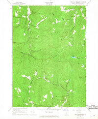 1966 Delectable Mountain1968 Print · USGSThe Green Mountain interior at the mid-point of the century shows a landscape of high ridges and isolated hollows. Researchers can trace the original route of the Appalachian Trail, locate Cem Smith, and find small settlements like Notown and Morgan Corners.3 unique versions available
 - 1985 Map of Rutland, 1988 Print
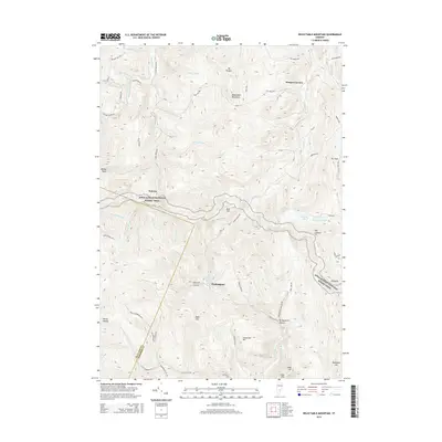
 1985 Rutland1988 Print · USGSThe Upper Valley of the mid-1980s comes to life along the winding Connecticut River as it divides the Green Mountain and Granite states. Historians can trace the industrial rail hubs of White River Junction and the paths of the Appalachian Trail and Long Trail.
 - 1996 Map of Delectable Mountain, 2000 Print
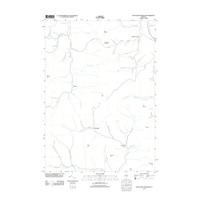
 1996 Delectable Mountain2000 Print · USGSThe Green Mountain interior of Windsor and Rutland counties comes into focus in this mid-nineties survey of high ridges and deep hollows. Researchers can trace remote locales like Notown, find the Stony Brook Shelter along the trail, and locate landmarks like Lakota Lake.
 - 2012 Map of Delectable Mountain, 2012 Print
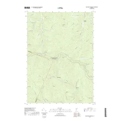
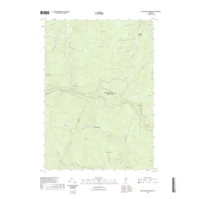
 2012 Delectable Mountain2012 Print · USGSCovers Notown, including Killington, Barnard, and other nearby areas
 - 2015 Map of Delectable Mountain, 2015 Print
 2015 Delectable Mountain2015 Print · USGSCovers Notown, including Killington, Barnard, and other nearby areas
 - 2018 Map of Delectable Mountain, 2018 Print
 2018 Delectable Mountain2018 Print · USGSCovers Notown, including Killington, Barnard, and other nearby areas
 - 2021 Map of Delectable Mountain, 2021 Print
 2021 Delectable Mountain2021 Print · USGSCovers Notown, including Killington, Barnard, and other nearby areas
 - 2024 Map of Delectable Mountain, 2024 Print
 2024 Delectable Mountain2024 Print · USGSHigh in the Green Mountains of Windsor County, this recent survey captures a landscape of remote hollows and high-elevation trails. Genealogists and hikers can trace the paths between Notown, Chateauguay, and Nye Cem along the Appalachian National Scenic Trail.
End of results
Showing maps 1-15 of 15
Top cities near Notown
- Randolph historical maps
- Hartland historical maps
- Woodstock historical maps
- Woodstock Village historical maps
- Royalton historical maps
- Clarendon historical maps
See more
Frequently asked questions
- What are the different types of historical maps available for Notown?
- What is the oldest map of Notown?
- Where can I purchase historical maps of Notown for my home or office?
- Where can I download high-res historical maps of Notown?
- Are there historical topographic maps available for Notown?
- Is there historical aerial imagery available for Notown?
- Where are historical maps of Notown sourced from?