Old Maps of Pea Hill Estates, Brunswick County
Explore 12 old maps of Pea Hill Estates, spanning from 1919 to today. These high-resolution historic maps reveal how streets, neighborhoods, landmarks, and natural features evolved over time — perfect for genealogy, metal detecting, research, and local history exploration.
What you can do with these maps:
- See how Pea Hill Estates changed over time: Compare historical maps to modern-day views to trace roads, homesites, rail lines & more.
- View detailed metadata: Each map includes creators, publishers, year, scale, and archive source.
- Overlay maps with satellite & LiDAR: Visualize the past alongside modern tools to explore terrain & human change.
- Trusted historical sources: Maps sourced from the USGS, Library of Congress, and other archives.
- Access maps your way: View online, download high-res files, or order prints for personal or research use.
Start exploring old maps of Pea Hill Estates to uncover forgotten places, hidden landmarks, and the deep history beneath your feet.
Pea Hill Estates, Brunswick County maps
(12)- 1919 Map of White Plains
 1919 White Plains1919 Print · USGSSouthern Virginia and the North Carolina borderlands are captured here at the close of the Great War. Genealogists can trace early twentieth-century communities through family-named landmarks like Vincents Store, Hicks Mill, and Holly Springs Church.
 - 1920 Map of White Plains
 1920 White Plains1920 Print · USGSThe Virginia and North Carolina borderlands come to life in this 1920 survey of the Meherrin and Roanoke river basins. Genealogists can trace family names at Drumgoole Store and Phipps Store, or locate old schoolhouse sites like Meherrin School and Webb School.4 unique versions available
 - 1953 Map of Norfolk, 1954 Print
 1953 Norfolk1954 Print · USGSCoastal Virginia and northeastern North Carolina appear here during the post-war industrial boom, showing the critical rail-and-sea connections of Hampton Roads. Genealogists can trace family roots through rural landmarks like Gethsemane Ch, the Caledonia State Prison Farm, and the vast interior of the Dismal Swamp.4 unique versions available
 - 1963 Map of Valentines, 1964 Print
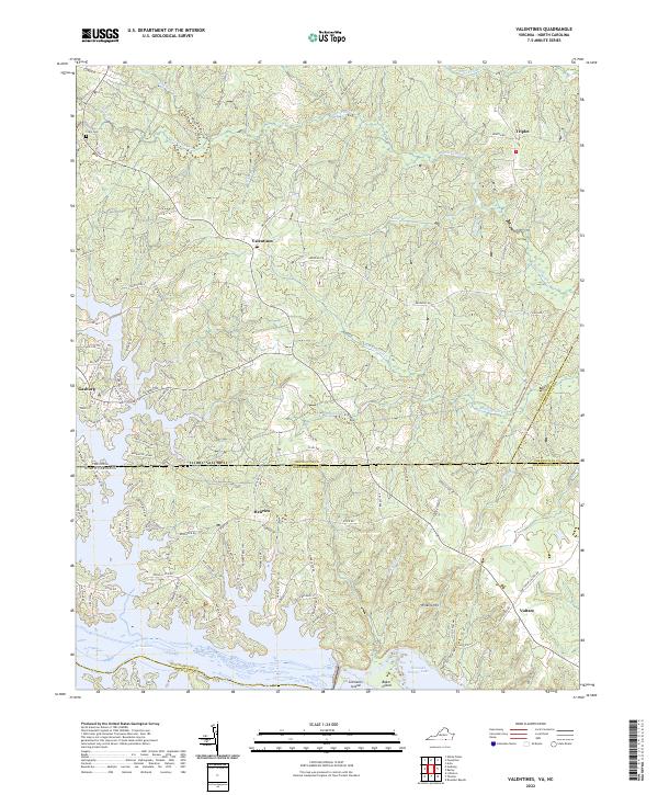
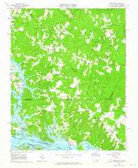 1963 Valentines1964 Print · USGSThe Virginia and North Carolina borderlands are captured in the early sixties as the reservoirs of Lake Gaston and Roanoke Rapids Lake shape the landscape. Researchers can trace rural community life through sites like Little Bethel Ch, Vultare, and the Old Railroad Grade.4 unique versions available
 - 1976 Map of Valentines, 1979 Print
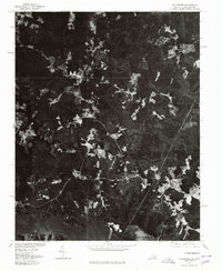 1976 Valentines1979 Print · USGSSpanning the Virginia and North Carolina border in the mid-seventies, this orthophoto captures the rural landscape as Lake Gaston reshaped the southern terrain. Researchers can identify precise field patterns and wooded tracts surrounding Valentines and Triplet.
 - 1984 Map of Emporia, 1986 Print
 1984 Emporia1986 Print · USGSSouthside Virginia and the North Carolina borderlands are captured here in the mid-1980s, centered on the transit hub of Emporia. Researchers can trace old rail corridors like the Seaboard System or locate historic sites including Fort Christanna and White Oak Ch.
 - 1990 Map of Emporia
 1990 Emporia1990 Print · USGSThe Southside Virginia borderlands are captured here in the late twentieth century, showing the critical rail and river networks of the region. Genealogists and local historians can trace family roots through rural communities like Alberta, Boykins, and Dolphin along the Meherrin River.
 - 2011 Map of Valentines, 2011 Print
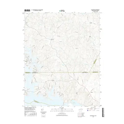
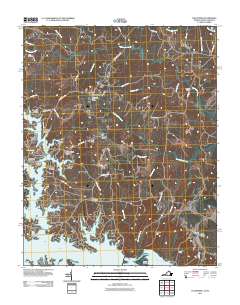 2011 Valentines2011 Print · USGSCovers Pea Hill Estates, including Pea Hill Shores, Henrico, and other nearby areas
 - 2013 Map of Valentines, 2013 Print
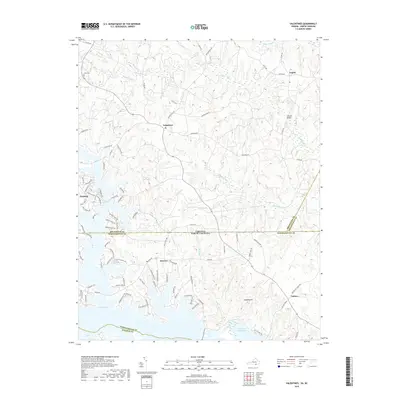
 2013 Valentines2013 Print · USGSCovers Pea Hill Estates, including Pea Hill Shores, Henrico, and other nearby areas
 - 2016 Map of Valentines, 2016 Print
 2016 Valentines2016 Print · USGSCovers Pea Hill Estates, including Pea Hill Shores, Henrico, and other nearby areas
 - 2019 Map of Valentines, 2019 Print
 2019 Valentines2019 Print · USGSCovers Pea Hill Estates, including Pea Hill Shores, Henrico, and other nearby areas
 - 2022 Map of Valentines, 2022 Print
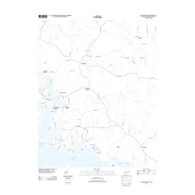
 2022 Valentines2022 Print · USGSThe Virginia-North Carolina borderlands are captured here in a period of modern lakeside development and rural continuity. Researchers can trace local lineage near Clary Cem or explore the waterfront evolution around Henrico and Lake Gaston.
End of results
Showing maps 1-12 of 12
Frequently asked questions
- What are the different types of historical maps available for Pea Hill Estates?
- What is the oldest map of Pea Hill Estates?
- Where can I purchase historical maps of Pea Hill Estates for my home or office?
- Where can I download high-res historical maps of Pea Hill Estates?
- Are there historical topographic maps available for Pea Hill Estates?
- Is there historical aerial imagery available for Pea Hill Estates?
- Where are historical maps of Pea Hill Estates sourced from?