Old Maps of Newport News, Virginia
Explore 52 old maps of Newport News, spanning from 1907 to today. These high-resolution historic maps reveal how streets, neighborhoods, landmarks, and natural features evolved over time — perfect for genealogy, metal detecting, research, and local history exploration.
What you can do with these maps:
- See how Newport News changed over time: Compare historical maps to modern-day views to trace roads, homesites, rail lines & more.
- View detailed metadata: Each map includes creators, publishers, year, scale, and archive source.
- Overlay maps with satellite & LiDAR: Visualize the past alongside modern tools to explore terrain & human change.
- Trusted historical sources: Maps sourced from the USGS, Library of Congress, and other archives.
- Access maps your way: View online, download high-res files, or order prints for personal or research use.
Start exploring old maps of Newport News to uncover forgotten places, hidden landmarks, and the deep history beneath your feet.
Newport News, VA maps
(52)- 1907 Map of Norfolk
 1907 Norfolk1907 Print · USGSCovers Newport News, including Virginia Beach, Chesapeake, and other nearby areas
 - 1907 Map of Yorktown
 1907 Yorktown1907 Print · USGSCovers Newport News, including Smithfield, Rushmere, and other nearby areas6 unique versions available
 - 1907 Map of Hampton, 1916 Print
 1907 Hampton1916 Print · USGSCovers Newport News, including Hampton, Poquoson, and other nearby areas6 unique versions available
 - 1919 Map of Smithfield
 1919 Smithfield1919 Print · USGSCovers Newport News, including Smithfield, Carrollton, and other nearby areas4 unique versions available
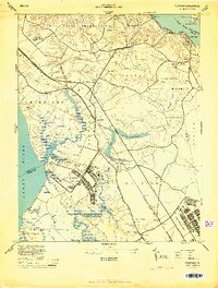
 - 1921 Map of Newport News
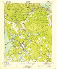
 1921 Newport News1921 Print · USGSCovers Newport News, including Norfolk, Portsmouth, and other nearby areas4 unique versions available
 - 1943 Map of Yorktown
 1943 Yorktown1943 Print · USGSCovers Newport News, including Smithfield, Rushmere, and other nearby areas
 - 1943 Map of Richmond, 1972 Print
 1943 Richmond1972 Print · USGSCovers Newport News, including Richmond, Hampton, and other nearby areas
 - 1944 Map of Yorktown
 1944 Yorktown1944 Print · USGSCovers Newport News, including Yorktown, Courthouse Green, and other nearby areas
 - 1944 Map of Morrison
 1944 Morrison1944 Print · USGSCovers Newport News, including Poquoson, Bethel Manor, and other nearby areas
 - 1944 Map of Harris Grove, 1953 Print
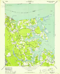 1944 Harris Grove1953 Print · USGSCovers Newport News, including Dandy, Seaford, and other nearby areas
 - 1948 Map of Norfolk North
 1948 Norfolk North1948 Print · USGSCovers Newport News, including Merrimack Park, Green Hill Farms, and other nearby areas2 unique versions available
 - 1948 Map of Bacons Castle, 1953 Print
 1948 Bacons Castle1953 Print · USGSCovers Newport News, including Rushmere, Poolesville, and other nearby areas
 - 1949 Map of Richmond, 1951 Print
 1949 Richmond1951 Print · USGSCovers Newport News, including Richmond, Hampton, and other nearby areas
 - 1950 Map of Blackstone
 1950 Blackstone1950 Print · USGSCovers Newport News, including Smithfield, Carrollton, and other nearby areas
 - 1950 Map of Mulberry Island, 1953 Print
 1950 Mulberry Island1953 Print · USGSCovers Newport News, including Smithfield, Wendwood, and other nearby areas
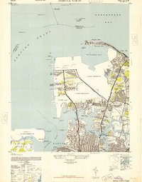
 - 1950 Map of Cobham Bay, 1953 Print
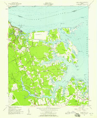
 1950 Cobham Bay1953 Print · USGSCovers Newport News, including Grove, Highgate, and other nearby areas
 - 1950 Map of Yorktown, 1954 Print
 1950 Yorktown1954 Print · USGSCovers Newport News, including Yorktown, Courthouse Green, and other nearby areas
 - 1951 Map of Blackstone, 1958 Print
 1951 Blackstone1958 Print · USGSCovers Newport News, including Smithfield, Carrollton, and other nearby areas
 - 1952 Map of Benns Church
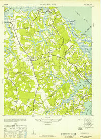 1952 Benns Church1952 Print · USGSCovers Newport News, including Smithfield, Carrollton, and other nearby areas
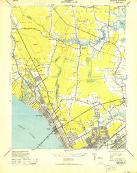
 - 1952 Map of Newport News
 1952 Newport News1952 Print · USGSCovers Newport News, including Christophers Shores, Hampton, and other nearby areas
 - 1953 Map of Norfolk, 1954 Print
 1953 Norfolk1954 Print · USGSCovers Newport News, including Chesapeake, Norfolk, and other nearby areas4 unique versions available
 - 1955 Map of Newport News, 1958 Print
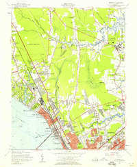
 1955 Newport News1958 Print · USGSCovers Newport News, including Christophers Shores, Hampton, and other nearby areas
 - 1955 Map of Morrison, 1958 Print
 1955 Morrison1958 Print · USGSCovers Newport News, including Poquoson, Bethel Manor, and other nearby areas
 - 1955 Map of Harris Grove, 1958 Print
 1955 Harris Grove1958 Print · USGSCovers Newport News, including Dandy, Seaford, and other nearby areas
 - 1955 Map of Norfolk North, 1958 Print
 1955 Norfolk North1958 Print · USGSCovers Newport News, including Merrimack Park, Green Hill Farms, and other nearby areas
Showing maps 1-25 of 52
Top cities of Newport News
Frequently asked questions
- What are the different types of historical maps available for Newport News?
- What is the oldest map of Newport News?
- Where can I purchase historical maps of Newport News for my home or office?
- Where can I download high-res historical maps of Newport News?
- Are there historical topographic maps available for Newport News?
- Is there historical aerial imagery available for Newport News?
- Where are historical maps of Newport News sourced from?