Old Maps of Brecon Park (Parks at Piedmont), Gainesville
Explore 31 old maps of Brecon Park (Parks at Piedmont), spanning from 1894 to today. These high-resolution historic maps reveal how streets, neighborhoods, landmarks, and natural features evolved over time — perfect for genealogy, metal detecting, research, and local history exploration.
What you can do with these maps:
- See how Brecon Park (Parks at Piedmont) changed over time: Compare historical maps to modern-day views to trace roads, homesites, rail lines & more.
- View detailed metadata: Each map includes creators, publishers, year, scale, and archive source.
- Overlay maps with satellite & LiDAR: Visualize the past alongside modern tools to explore terrain & human change.
- Trusted historical sources: Maps sourced from the USGS, Library of Congress, and other archives.
- Access maps your way: View online, download high-res files, or order prints for personal or research use.
Start exploring old maps of Brecon Park (Parks at Piedmont) to uncover forgotten places, hidden landmarks, and the deep history beneath your feet.
Brecon Park (Parks at Piedmont), Gainesville maps
(31)- 1894 Map of Warrenton
 1894 Warrenton1894 Print · USGSVirginia's northern Piedmont and mountain gaps are mapped here in the late nineteenth century as the rail-and-river economy flourished. Genealogists can trace family names and small crossroads from Warrenton and Brentsville to White Sulphur Springs.9 unique versions available
 - 1933 Map of Middleburg
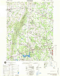
 1933 Middleburg1933 Print · USGSNorthern Virginia is captured here in the years following the Great War, showing a landscape defined by its ridges and historical milestones. Genealogists and historians can locate family landmarks like the Henry House, Beverly Mill, and rural centers such as Hickory Grove.
 - 1943 Map of Thorofare Gap, 1960 Print
 1943 Thorofare Gap1960 Print · USGSNorthern Virginia at the height of the Second World War shows a landscape defined by the ridgeline of the Bull Run Mountains. Genealogists and local historians can trace the foundations of communities like Haymarket and Buckland or locate specific sites like Beverly Mills and Vint Hill Farm Military Reservation.
 - 1944 Map of Thorofare Gap
 1944 Thorofare Gap1944 Print · USGSPrince William and Fauquier counties are shown here during the Second World War as the region’s strategic gaps and rail lines remained vital to Virginia's interior. Genealogists and researchers can trace rural landmarks from Vint Hill Farm to Beverly Mills and St Pauls Ch.
 - 1948 Map of Washington
 1948 Washington1948 Print · USGSThe Potomac and Chesapeake regions in the late 1940s reveal a landscape of expanding military reach and deep-rooted Tidewater settlements. Trace old rail corridors like the Richmond Fredericksburg & Potomac RR or locate landmarks like the Wakefield Washington Monument and St. Marys College.2 unique versions available
 - 1953 Map of Gainesville, 1954 Print
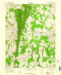
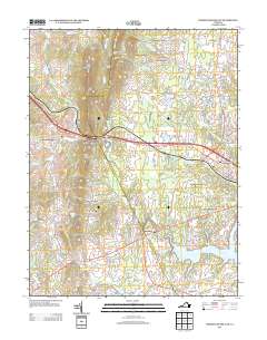
 1953 Gainesville1954 Print · USGSThe hallowed ground of Prince William County is documented here in the early fifties, just as the region began to balance its deep Civil War history with post-war growth. Researchers can trace ancestral connections through sites like Sudley Springs, the Groveton Confederate Cem, and the Vinton Hall Sch.2 unique versions available
 - 1957 Map of Washington, 1966 Print
 1957 Washington1966 Print · USGSThe mid-Atlantic region during the mid-fifties and early sixties reveals a landscape of growing suburbs and vital military outposts. Researchers can trace historic river towns and shorelines from Alexandria to the Hooper Islands and St Clements Island.5 unique versions available
 - 1961 Map of Washington
 1961 Washington1961 Print · USGSThe mid-Atlantic region in the late fifties is presented in remarkable detail, from the Blue Ridge foothills to the Chesapeake Eastern Shore. Researchers can trace historic river landings and military sites like Mount Vernon, Fort Belvoir, and Point Lookout.2 unique versions available
 - 1966 Map of Thoroughfare Gap, 1969 Print
 1966 Thoroughfare Gap1969 Print · USGSPrince William and Fauquier counties are captured here in the mid-1960s as the railroad and highways thread through the Bull Run Mountains. Researchers can locate several rural landmarks including Beverley Mill, the Antioch-McCrae Sch, and the Vint Hill Farms Station Military Reservation.3 unique versions available
 - 1968 Map of Gainesville, 1970 Print
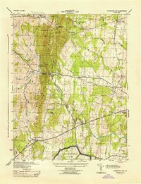
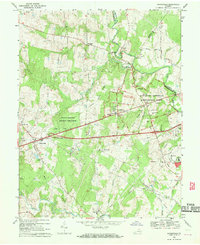 1968 Gainesville1970 Print · USGSGainesville and the surrounding Prince William County countryside are captured here in the late sixties, just as modern infrastructure began to meet the area's deep Civil War legacy. Local historians can locate the Stone Bridge and Dogan House on the battlefield, or trace family landmarks like Mt Calvary Ch and Sudley Springs.6 unique versions available
 - 1972 Map of Gainesville, 1974 Print
 1972 Gainesville1974 Print · USGSGainesville appears at a pivotal moment in the early seventies, caught between its rural agricultural past and its suburban future. Researchers can trace the original field patterns and wooded tracts along Bull Run or examine the early layout of Gainesville.
 - 1977 Map of Gainesville
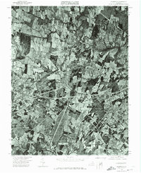
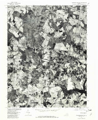
 1977 Gainesville1977 Print · USGSPrince William County is seen in the late 1970s, captured in detailed aerial photography before the height of its modern expansion. Researchers can trace the original footprints of Gainesville and Manassas or locate rural landmarks near Sudley Springs.
 - 1977 Map of Middleburg, 1979 Print
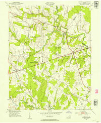
 1977 Middleburg1979 Print · USGSNorthern Virginia in the late seventies reveals a landscape transitioning from rural estate country to a growing suburban corridor. Researchers can locate significant Civil War sites at Manassas National Battlefield Park and trace family names through Buchannon Gap Cem or the Linton Hall Military Sch.
 - 1977 Map of Thoroughfare Gap, 1982 Print
 1977 Thoroughfare Gap1982 Print · USGSNorthern Virginia in the late seventies is captured in this aerial survey as rural tracts began to meet modern expansion. Genealogists and local historians can trace the property lines and road networks around Haymarket, Buckland, and Antioch.
 - 1982 Map of Washington West, 1983 Print
 1982 Washington West1983 Print · USGSThe Virginia and Maryland suburbs were undergoing intense development in the early eighties as the capital region expanded outward. Researchers can trace the footprint of Cold War-era defense sites like Fort Belvoir and Vint Hill Farms Station alongside growing academic centers like George Mason University.
 - 1983 Map of Gainesville, 1996 Print
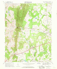
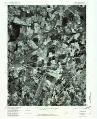
 1983 Gainesville1996 Print · USGSGainesville and the surrounding Prince William County countryside are shown during a period of rapid development in the 1980s. Researchers can trace the proximity of modern residential growth to the hallowed grounds of Manassas National Battlefield Park and the Groveton Confederate Cem.
 - 1986 Map of Washington West
 1986 Washington West1986 Print · USGSNorthern Virginia and the D.C. metro area are captured here in the mid-eighties as suburban growth began to meet rural Fauquier County. Trace the development of the corridor from Alexandria out to Dulles and the preserved lands of Prince William Forest Park.2 unique versions available
 - 1989 Map of Washington
 1989 Washington1989 Print · USGSThe Potomac River valley and Chesapeake Bay are shown in comprehensive detail during the late 1980s. Genealogists and historians can trace the transition from urban Alexandria to the rural Northern Neck, locating landmarks like Mount Vernon and Stratford Hall.
 - 1989 Map of Thoroughfare Gap, 1996 Print
 1989 Thoroughfare Gap1996 Print · USGSPrince William and Fauquier counties are seen here in the late eighties, just as suburban expansion began meeting the rural foothills. Researchers can trace historic mountain passages at Thoroughfare Gap or locate the Georgetown Cem and Vint Hill Farms Station.
 - 1994 Map of Gainesville, 1998 Print
 1994 Gainesville1998 Print · USGSNorthern Virginia in the late nineties shows a landscape where suburban growth meets the commemorative grounds of Manassas National Battlefield Park. Researchers can trace the legacy of the region through landmarks like the Groveton Confederate Cem and the Norfolk Southern rail line.
 - 1994 Map of Thoroughfare Gap, 1998 Print
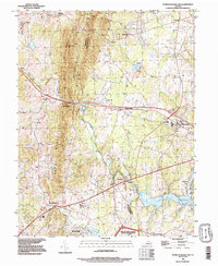
 1994 Thoroughfare Gap1998 Print · USGSThe Bull Run Mountains and Thoroughfare Gap define this Prince William County landscape during the mid-nineties. Genealogists and historians can trace old community centers like Haymarket and Buckland or the extent of Vint Hill Farms Station.
 - 2010 Map of Gainesville, 2010 Print
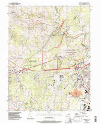
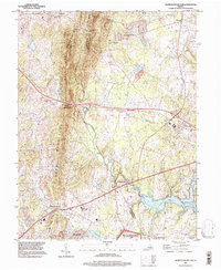
 2010 Gainesville2010 Print · USGSCovers Brecon Park (Parks at Piedmont), including Linton Hall, Gainesville, and other nearby areas
 - 2010 Map of Thoroughfare Gap, 2010 Print
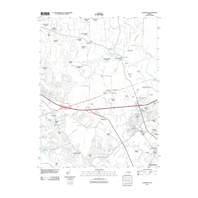
 2010 Thoroughfare Gap2010 Print · USGSCovers Brecon Park (Parks at Piedmont), including Gainesville, Haymarket, and other nearby areas
 - 2013 Map of Gainesville, 2013 Print
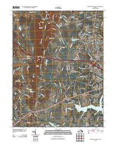
 2013 Gainesville2013 Print · USGSCovers Brecon Park (Parks at Piedmont), including Linton Hall, Gainesville, and other nearby areas
 - 2013 Map of Thoroughfare Gap, 2013 Print
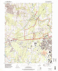
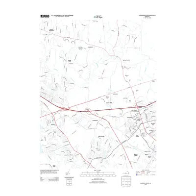
 2013 Thoroughfare Gap2013 Print · USGSCovers Brecon Park (Parks at Piedmont), including Gainesville, Haymarket, and other nearby areas
Showing maps 1-25 of 31
Frequently asked questions
- What are the different types of historical maps available for Brecon Park (Parks at Piedmont)?
- What is the oldest map of Brecon Park (Parks at Piedmont)?
- Where can I purchase historical maps of Brecon Park (Parks at Piedmont) for my home or office?
- Where can I download high-res historical maps of Brecon Park (Parks at Piedmont)?
- Are there historical topographic maps available for Brecon Park (Parks at Piedmont)?
- Is there historical aerial imagery available for Brecon Park (Parks at Piedmont)?
- Where are historical maps of Brecon Park (Parks at Piedmont) sourced from?