Old Maps of Radford City, Virginia
Explore 20 old maps of Radford City, spanning from 1890 to today. These high-resolution historic maps reveal how streets, neighborhoods, landmarks, and natural features evolved over time — perfect for genealogy, metal detecting, research, and local history exploration.
What you can do with these maps:
- See how Radford City changed over time: Compare historical maps to modern-day views to trace roads, homesites, rail lines & more.
- View detailed metadata: Each map includes creators, publishers, year, scale, and archive source.
- Overlay maps with satellite & LiDAR: Visualize the past alongside modern tools to explore terrain & human change.
- Trusted historical sources: Maps sourced from the USGS, Library of Congress, and other archives.
- Access maps your way: View online, download high-res files, or order prints for personal or research use.
Start exploring old maps of Radford City to uncover forgotten places, hidden landmarks, and the deep history beneath your feet.
Radford City, VA maps
(20)- 1890 Map of Dublin
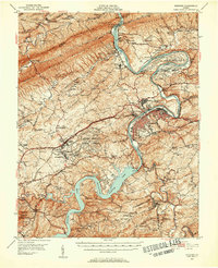
 1890 Dublin1890 Print · USGSThe mountainous borderlands of Virginia and West Virginia are captured here in the late nineteenth century as industry and rail expanded along the New River. Genealogists and historians can trace the foundations of local commerce through sites like Pearisburg, the Belle Hampton Mine, and river crossings at Peppers Ferry.
 - 1891 Map of Dublin
 1891 Dublin1891 Print · USGSAcross Southwest Virginia and West Virginia in the late nineteenth century, the river and rail lines dictated the pace of mountain life. Genealogists can trace family footprints through numerous river crossings like Ingles Ferry and historic industry sites like Altoona Mines and Mercers Salt Works.9 unique versions available
 - 1950 Map of Radford, 1952 Print
 1950 Radford1952 Print · USGSThe New River valley and the newly formed Claytor Lake are captured here at the start of the 1950s. Genealogists and historians can locate family-named sites like Goodwins Ferry, Hickman Cem, and schools such as Walton Sch No 1.3 unique versions available
 - 1955 Map of Bluefield
 1955 Bluefield1955 Print · USGSThe Central Appalachian borderlands come alive in the mid-fifties, showing the coal and rail networks connecting Bluefield to Beckley. Researchers can trace the industrial landscape of the New River Ordnance Plant and the terrain of Burkes Garden.
 - 1957 Map of Bluefield, 1967 Print
 1957 Bluefield1967 Print · USGSThe heart of Central Appalachia in the mid-fifties is defined by the winding rail lines and river valleys of the coalfields. Researchers can trace the industrial footprints of towns like Welch and Princeton or locate landmarks such as the Bluestone Reservoir and Claytor Lake.2 unique versions available
 - 1961 Map of Bluefield
 1961 Bluefield1961 Print · USGSThe coalfields and mountain ridges of southern West Virginia and southwest Virginia are captured in the early sixties. Genealogists can trace family ties through rail-linked towns like Princeton and Richlands or along the shores of Bluestone Reservoir.
 - 1965 Map of Radford North, 1966 Print
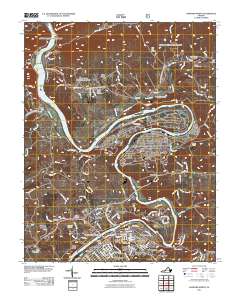
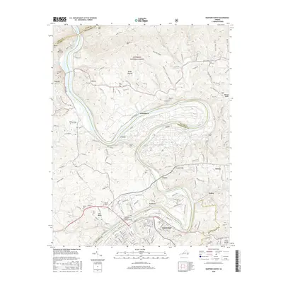
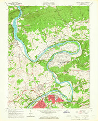 1965 Radford North1966 Print · USGSRadford and the surrounding New River valley are seen here in the mid-sixties, dominated by a mix of military industry and university life. Genealogists and historians can trace local landmarks like Morgans Chapel, the Radford Army Ammunition Plant, and several old mining sites on Brush Mountain.4 unique versions available
 - 1965 Map of Radford South, 1966 Print
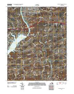
 1965 Radford South1966 Print · USGSPulaski and Montgomery counties are captured in the mid-1960s as the New River valley balances industrial growth with rural tradition. Genealogists can trace family names through landmarks like Snowville, Simpkinstown, and schools like Bethel Sch.5 unique versions available
 - 1982 Map of Radford, 1983 Print
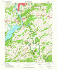
 1982 Radford1983 Print · USGSThe New River Valley and surrounding highlands are shown during a period of significant regional growth in the early eighties. Genealogists and historians can trace the development of VPI, locate historic sites like Yellow Sulphur Springs, and follow the Norfolk and Western rail lines through the gaps.2 unique versions available
 - 1998 Map of Radford North, 2000 Print
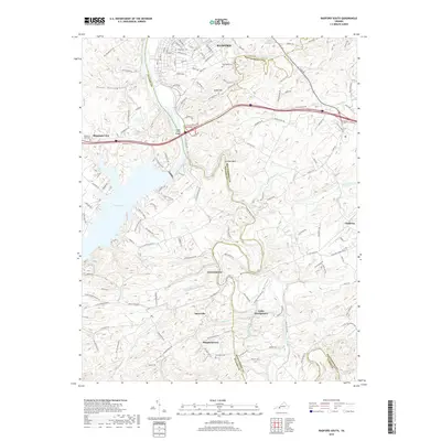
 1998 Radford North2000 Print · USGSThe New River valley and Radford area are shown here as they appeared in the late twentieth century, balancing industrial operations with quiet mountain settlements. Researchers can trace the sprawling Radford Army Ammunition Plant or locate genealogy sites like Wake Forest Sch and Morgans Chapel.
 - 2011 Map of Radford North, 2011 Print
 2011 Radford North2011 Print · USGSCovers Radford City, including Radford, Fairlawn, and other nearby areas
 - 2011 Map of Radford South, 2011 Print
 2011 Radford South2011 Print · USGSCovers Radford City, including Snowville, Simpkinstown, and other nearby areas
 - 2013 Map of Radford North, 2013 Print
 2013 Radford North2013 Print · USGSCovers Radford City, including Radford, Fairlawn, and other nearby areas
 - 2013 Map of Radford South, 2013 Print
 2013 Radford South2013 Print · USGSCovers Radford City, including Snowville, Simpkinstown, and other nearby areas
 - 2016 Map of Radford North, 2016 Print
 2016 Radford North2016 Print · USGSCovers Radford City, including Radford, Fairlawn, and other nearby areas
 - 2016 Map of Radford South, 2016 Print
 2016 Radford South2016 Print · USGSCovers Radford City, including Snowville, Simpkinstown, and other nearby areas
 - 2019 Map of Radford South, 2019 Print
 2019 Radford South2019 Print · USGSCovers Radford City, including Snowville, Simpkinstown, and other nearby areas
 - 2019 Map of Radford North, 2019 Print
 2019 Radford North2019 Print · USGSCovers Radford City, including Radford, Fairlawn, and other nearby areas
 - 2022 Map of Radford North, 2022 Print
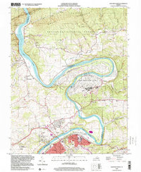
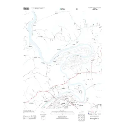
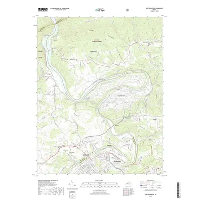
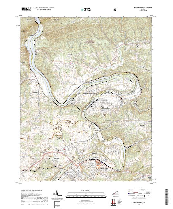 2022 Radford North2022 Print · USGSModern-day Montgomery County and the city of Radford are shown here as the New River winds through the Great Valley. Researchers can locate the Radford Army Ammunition Plant, the Radford University campus, and several historic burial sites like Wake Forest Cem.
 - 2022 Map of Radford South, 2022 Print
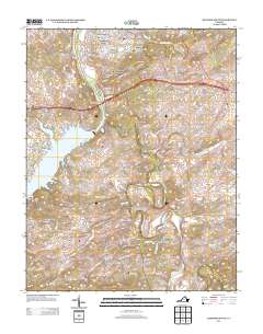
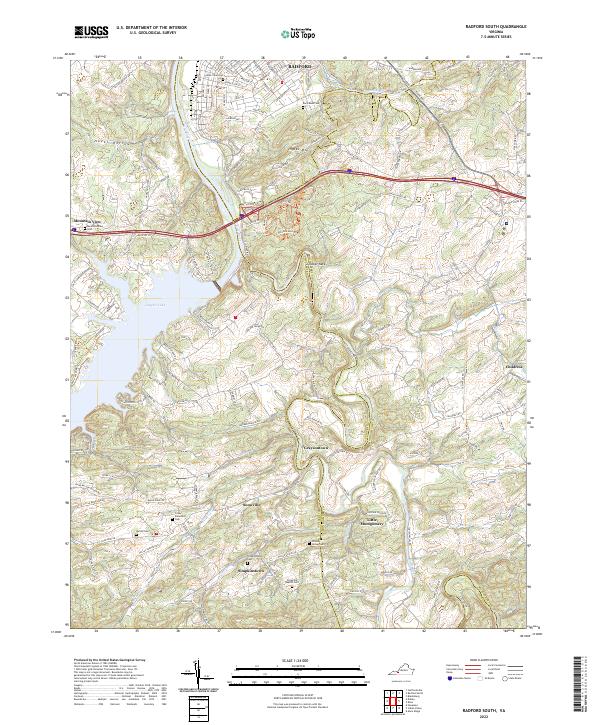 2022 Radford South2022 Print · USGSThe Radford area and its rural surroundings appear here as the highlands descend toward the New River valley. Researchers can trace family history through numerous burial sites like Dishon Cem and Covey Showalter Cem, or explore the old routes through Snowville and Graysontown.
End of results
Showing maps 1-20 of 20
Top cities of Radford City
Frequently asked questions
- What are the different types of historical maps available for Radford City?
- What is the oldest map of Radford City?
- Where can I purchase historical maps of Radford City for my home or office?
- Where can I download high-res historical maps of Radford City?
- Are there historical topographic maps available for Radford City?
- Is there historical aerial imagery available for Radford City?
- Where are historical maps of Radford City sourced from?