Old Maps of Riverside, Washington
Explore 20 old maps of Riverside, spanning from 1902 to today. These high-resolution historic maps reveal how streets, neighborhoods, landmarks, and natural features evolved over time — perfect for genealogy, metal detecting, research, and local history exploration.
What you can do with these maps:
- See how Riverside changed over time: Compare historical maps to modern-day views to trace roads, homesites, rail lines & more.
- View detailed metadata: Each map includes creators, publishers, year, scale, and archive source.
- Overlay maps with satellite & LiDAR: Visualize the past alongside modern tools to explore terrain & human change.
- Trusted historical sources: Maps sourced from the USGS, Library of Congress, and other archives.
- Access maps your way: View online, download high-res files, or order prints for personal or research use.
Start exploring old maps of Riverside to uncover forgotten places, hidden landmarks, and the deep history beneath your feet.
Riverside, WA maps
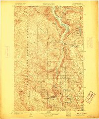
(20)- 1902 Map of Osoyoos
 1902 Osoyoos1902 Print · USGSOkanogan County at the dawn of the twentieth century was a landscape of high-country mines and riverfront settlements along the Canadian border. Genealogists and historians can trace early mining operations at Okanogan Free Gold Mine or locate early towns like Molson, Chesaw, and Oroville.
 - 1904 Map of Osoyoos
 1904 Osoyoos1904 Print · USGSOkanogan County near the Canadian border is shown here during a period of mining expansion and early ranching. You can trace the proximity of the Okanogan Free Gold Mine to Oroville or locate early settlements like Molson, Chesaw, and Huntley Ranch.3 unique versions available
 - 1905 Map of Okanogan
 1905 Okanogan1905 Print · USGSThe Okanogan and Columbia rivers converge in this early 1900s survey, showing the region when river ferries were the primary links between frontier settlements. Researchers can trace the original locations of Bruster, Alma, and Olema, or locate historical river crossings like Central Ferry and Andrews Ferry.3 unique versions available
 - 1906 Map of Chopaka
 1906 Chopaka1906 Print · USGSNorthern Washington at the turn of the century shows a frontier defined by mining camps and mountain passes along the Canadian border. Trace the early Okanogan mining boom through the Grandview Mine, the remote Nighthawk settlement, and Conconully.3 unique versions available
 - 1953 Map of Omak Lake, 1956 Print
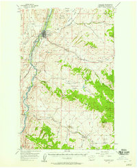
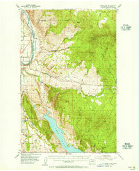 1953 Omak Lake1956 Print · USGSThe Okanogan River valley and the Colville Indian Reservation are captured here in the early fifties, showing the region's transition into the modern era. Genealogists and historians can trace the Great Northern rail line and locate landmarks like St Marys Mission and the settlement of Riverside.2 unique versions available
 - 1954 Map of Okanogan, 1964 Print
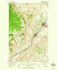
 1954 Okanogan1964 Print · USGSNorth Central Washington’s interior comes into focus during the mid-fifties, showing the rise of the Columbia River reservoir system. Genealogists and historians can trace the Great Northern rail line and locate historical mining operations at the Mountain Lion Mine or Gold Hill Mine.2 unique versions available
 - 1957 Map of Okanogan
 1957 Okanogan1957 Print · USGSThe Okanogan River valley comes alive in this late-fifties survey, capturing the region's growth along the Great Northern rail line. Trace the development of Okanogan and Omak, or locate family sites at Malott, the Ruby mining site, and Okanogan Cemetery.2 unique versions available
 - 1957 Map of Conconully, 1958 Print
 1957 Conconully1958 Print · USGSOkanogan County in the late fifties shows a landscape of mountain mining and valley ranching defined by the Salmon River drainage. Researchers can trace the Great Northern rail line and find historic sites like the Silver Mts Mine and Beeman School.3 unique versions available
 - 1957 Map of Tonasket, 1958 Print
 1957 Tonasket1958 Print · USGSThe Okanogan River valley in the late fifties was a vital corridor of rail and river industry. Genealogists and historians can trace the foundations of local life through the Great Northern rail stops, the Chewiliken Sch, and ancient Petroglyphs near Anglin.2 unique versions available
 - 1958 Map of Okanogan
 1958 Okanogan1958 Print · USGSThe Okanogan River valley and the Colville Indian Reservation are shown here in the late fifties, during a period of established river and rail commerce. Researchers can trace the Great Northern line through Oroville or locate landmarks like the Knowlton School and Orient Ranger Station.
 - 1980 Map of Omak
 1980 Omak1980 Print · USGSThe Okanogan River valley comes into focus during the early 1980s, showcasing the development between Omak and Okanogan. Genealogists and historians can trace family sites at Okanogan Memorial Gardens, the Brook Mine, and Wenatchee Valley College.2 unique versions available
 - 1980 Map of Keystone, 1981 Print
 1980 Keystone1981 Print · USGSThe Okanogan River valley in the late 1970s shows a landscape shaped by river transport and high-country ranching. Genealogists and researchers can trace the Burlington Northern line and family landmarks like Figlenski Spring and Bob Neal Lake.
 - 1980 Map of The Pothole, 1981 Print
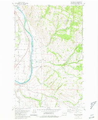 1980 The Pothole1981 Print · USGSOkanogan County's river valley and reservation lands are captured here in the mid-1970s. Local researchers can trace the Burlington Northern line past Cherokee and locate historical sites like St Marys Mission and Riverview Cem.2 unique versions available
 - 1981 Map of Riverside
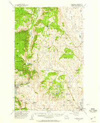
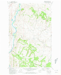
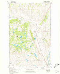 1981 Riverside1981 Print · USGSThe Okanogan River valley in the early 1980s features a landscape of hidden caves and isolated ranching corrals. Researchers can trace the path of the historic Wagon Road and locate local landmarks such as Albright Cave and the Riverside rail line.
 - 1983 Map of Omak
 1983 Omak1983 Print · USGSIn the early 1980s, the Okanogan and Columbia river valleys served as a vital agricultural and timber hub. Researchers can trace family-named landmarks like Pearl Hill and Jackass Butte, alongside vanished mining history at the Red Shirt Mine.2 unique versions available
 - 1984 Map of Oroville
 1984 Oroville1984 Print · USGSThe Okanogan highlands at the Canadian border reveal a landscape of deep river valleys and historic mining claims in the early 1980s. Genealogists and researchers can trace old settlements like Nighthawk and Loomis or locate the American Girl Mine.
 - 2023 Map of The Pothole, 2023 Print
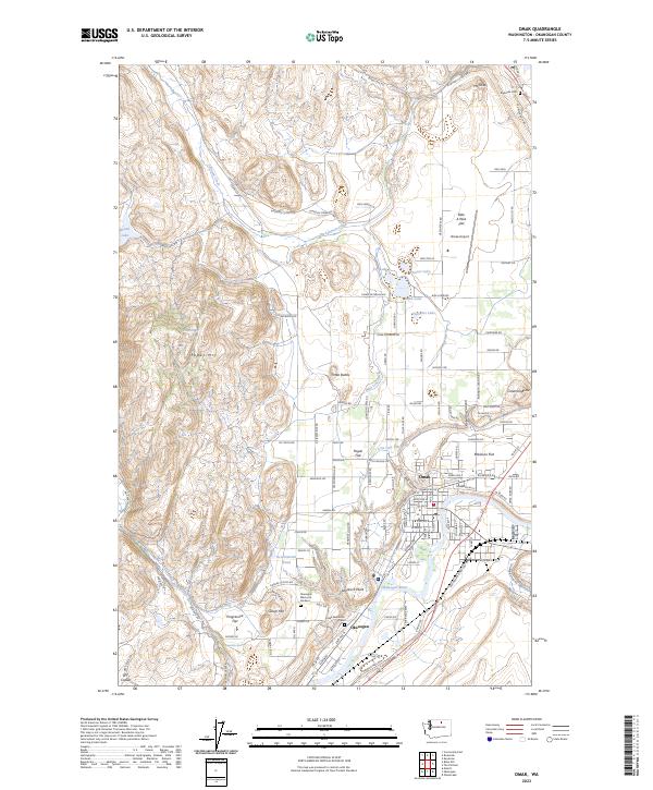
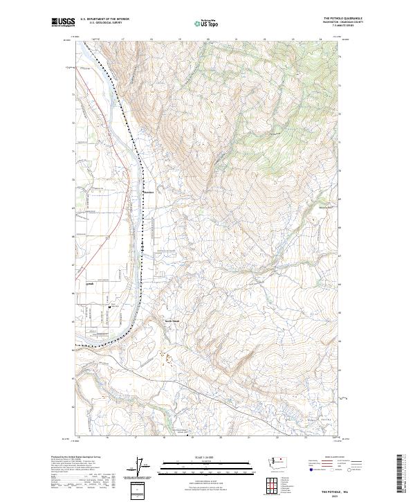 2023 The Pothole2023 Print · USGSThe Okanogan River valley comes alive in this contemporary survey of the settlements and highland canyons north of the river. Genealogists and local historians can trace the grounds of Saint Marys Mission Catholic Cem and Sand Flats Cem or explore the drainage of Pothole Canyon.
 - 2023 Map of Keystone, 2023 Print
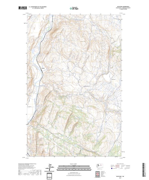 2023 Keystone2023 Print · USGSOkanogan County’s high country comes into focus in this contemporary survey of the river valley and its surrounding peaks. Genealogists and researchers can trace family-named landmarks like Figlenski Spring, the settlement at Barker, and the high crossing at Lockman Pass.
 - 2023 Map of Riverside, 2023 Print
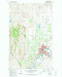
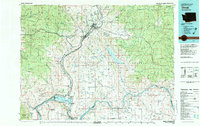
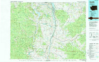
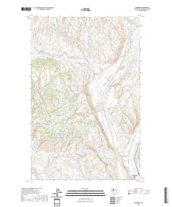 2023 Riverside2023 Print · USGSRiverside and the Okanogan River valley are captured here in the early twenty-first century, showing the intersection of river, rail, and upland lake country. Researchers can trace the rugged local geography through family-named landmarks like Booher Lake, Chilson Mtn, and the distinctive Wagonroad Coulee.
 - 2023 Map of Omak, 2023 Print
 2023 Omak2023 Print · USGSThe Okanogan River valley and its surrounding agricultural plateaus are documented here in recent years. Researchers can trace irrigation networks and family sites across Pogue Flat, Robinson Flat, and near the Omak Memorial Cem.
End of results
Showing maps 1-20 of 20
Top cities near Riverside
Frequently asked questions
- What are the different types of historical maps available for Riverside?
- What is the oldest map of Riverside?
- Where can I purchase historical maps of Riverside for my home or office?
- Where can I download high-res historical maps of Riverside?
- Are there historical topographic maps available for Riverside?
- Is there historical aerial imagery available for Riverside?
- Where are historical maps of Riverside sourced from?