Old Maps of Bedal, Washington
Explore 11 old maps of Bedal, spanning from 1899 to today. These high-resolution historic maps reveal how streets, neighborhoods, landmarks, and natural features evolved over time — perfect for genealogy, metal detecting, research, and local history exploration.
What you can do with these maps:
- See how Bedal changed over time: Compare historical maps to modern-day views to trace roads, homesites, rail lines & more.
- View detailed metadata: Each map includes creators, publishers, year, scale, and archive source.
- Overlay maps with satellite & LiDAR: Visualize the past alongside modern tools to explore terrain & human change.
- Trusted historical sources: Maps sourced from the USGS, Library of Congress, and other archives.
- Access maps your way: View online, download high-res files, or order prints for personal or research use.
Start exploring old maps of Bedal to uncover forgotten places, hidden landmarks, and the deep history beneath your feet.
Bedal, WA maps
(11)- 1899 Map of Glacier Peak, 1955 Print
 1899 Glacier Peak1955 Print · USGSThe high North Cascades appear here just before the turn of the century, detailing the early outposts and massive ice fields of the region. Researchers can trace the original trails between Mineral Park and Gilbert or locate high-altitude landmarks like Suiattle Glacier and Monte Cristo Lake.2 unique versions available
 - 1901 Map of Glacier Peak
 1901 Glacier Peak1901 Print · USGSThe North Cascades wilderness is captured here at the end of the 19th century, during the early years of the Washington Forest Reserve. Local historians can trace the high-country outposts of Gilbert and Stehekin, as well as the original boundaries of the Horseshoe Basin and Cascade Pass.6 unique versions available
 - 1955 Map of Concrete, 1967 Print
 1955 Concrete1967 Print · USGSThe North Cascades in the mid-fifties reveal a landscape of deep glacier-fed lakes and riverside timber towns. You can trace the Great Northern rail lines through Granite Falls or locate remote outposts like Stehekin and Marblemount along the Skagit and Chelan waters.
 - 1958 Map of Concrete
 1958 Concrete1958 Print · USGSThe North Cascades and Skagit Valley are captured here in the late fifties, showing a landscape defined by glacier-carved peaks and river-bottom settlements. Genealogists and historians can locate remote mining sites like Holden Mine and mountain outposts such as Stehekin, Marblemount, and Mazama.2 unique versions available
 - 1962 Map of Concrete
 1962 Concrete1962 Print · USGSThe Northern Cascades in the early sixties reveal a landscape of high alpine peaks and deep river valleys before the modern park era. Genealogists and historians can trace rail-and-river towns like Concrete, Darrington, and Stehekin, alongside industry at the Holden Mine.
 - 1966 Map of Bedal, 1968 Print
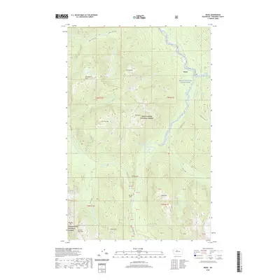
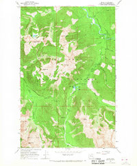 1966 Bedal1968 Print · USGSThe Snohomish County backcountry is captured here in the mid-1960s as a hub for timber management and alpine recreation. Trace the routes of early explorers and miners along the Sunrise Mine Trail, and locate historic forest sites like the North Fork Guard Sta and Bedal.4 unique versions available
 - 2011 Map of Bedal, 2011 Print
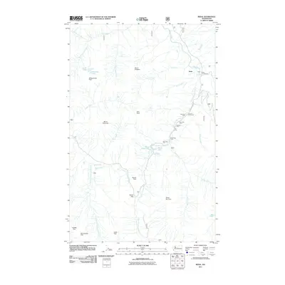 2011 Bedal2011 Print · USGSCovers Bedal, including Snohomish County, United States, and other nearby areas
 - 2014 Map of Bedal, 2014 Print
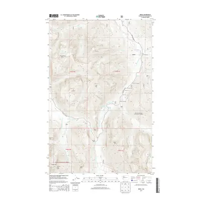 2014 Bedal2014 Print · USGSCovers Bedal, including Snohomish County, United States, and other nearby areas
 - 2017 Map of Bedal, 2017 Print
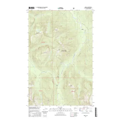 2017 Bedal2017 Print · USGSCovers Bedal, including Snohomish County, United States, and other nearby areas
 - 2020 Map of Bedal, 2020 Print
 2020 Bedal2020 Print · USGSCovers Bedal, including Snohomish County, United States, and other nearby areas
 - 2023 Map of Bedal, 2023 Print
 2023 Bedal2023 Print · USGSThe Sauk River forks meet at Bedal in this contemporary look at the Snohomish County high country. Researchers can trace historical routes through Barlow Pass or follow the Sunrise Mine Trl and Old Sauk Trl into the Cascades.
End of results
Showing maps 1-11 of 11
Frequently asked questions
- What are the different types of historical maps available for Bedal?
- What is the oldest map of Bedal?
- Where can I purchase historical maps of Bedal for my home or office?
- Where can I download high-res historical maps of Bedal?
- Are there historical topographic maps available for Bedal?
- Is there historical aerial imagery available for Bedal?
- Where are historical maps of Bedal sourced from?