Old Maps of Wautoma, Wisconsin
Explore 5 old maps of Wautoma, spanning from 1955 to today. These high-resolution historic maps reveal how streets, neighborhoods, landmarks, and natural features evolved over time — perfect for genealogy, metal detecting, research, and local history exploration.
What you can do with these maps:
- See how Wautoma changed over time: Compare historical maps to modern-day views to trace roads, homesites, rail lines & more.
- View detailed metadata: Each map includes creators, publishers, year, scale, and archive source.
- Overlay maps with satellite & LiDAR: Visualize the past alongside modern tools to explore terrain & human change.
- Trusted historical sources: Maps sourced from the USGS, Library of Congress, and other archives.
- Access maps your way: View online, download high-res files, or order prints for personal or research use.
Start exploring old maps of Wautoma to uncover forgotten places, hidden landmarks, and the deep history beneath your feet.
Wautoma, WI maps
(5)- 1955 Map of Green Bay, 1968 Print
 1955 Green Bay1968 Print · USGSCentral and Eastern Wisconsin are captured here in the mid-fifties, showing the industrial growth of the Fox Valley and Wisconsin River corridors. Genealogists and historians can trace rail lines like the Green Bay and Western through settlements like Weyauwega, Clintonville, and Pulaski.2 unique versions available
 - 1959 Map of Wautoma, 1961 Print
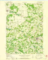 1959 Wautoma1961 Print · USGSWaushara County in the late fifties shows a rural landscape defined by glacial lakes and a developing transportation network. Genealogists can trace family names through numerous sites like Richford Cem, West Holden Ch, and St Pauls Cem.
 - 1968 Map of Wautoma, 1971 Print
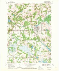 1968 Wautoma1971 Print · USGSWautoma and its surrounding glacial lakes are seen here in the late sixties, as the local economy balanced rail transport with emerging recreation. Local researchers can locate several rural burial grounds like North Dakota Cemetery and trace the old Chicago and North Western line.
 - 1985 Map of Wisconsin Rapids
 1985 Wisconsin Rapids1985 Print · USGSCentral Wisconsin in the mid-eighties shows a landscape of engineered waterways and active rail corridors between Wisconsin Rapids and Waupaca. Genealogists and researchers can trace local landmarks like Roche A Cri State Park, the SOO LINE, and small settlements like Coddington or Rudolph.2 unique versions available
 - 2022 Map of Wautoma, 2022 Print
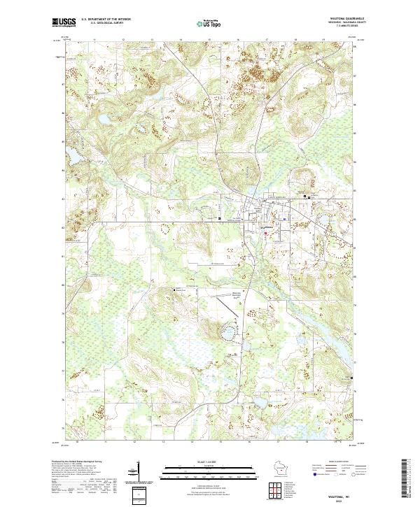 2022 Wautoma2022 Print · USGSThe city of Wautoma and the surrounding lake country are shown here in the early twenty-first century as a well-developed regional hub. Genealogists can trace family names through local burial grounds like Wautoma Union Cem and Maple Grove Cem.
End of results
Showing maps 1-5 of 5
Top cities near Wautoma
- Redgranite historical maps
- Princeton historical maps
- Wild Rose historical maps
- Plainfield historical maps
- Coloma historical maps
- Neshkoro historical maps
See more
Frequently asked questions
- What are the different types of historical maps available for Wautoma?
- What is the oldest map of Wautoma?
- Where can I purchase historical maps of Wautoma for my home or office?
- Where can I download high-res historical maps of Wautoma?
- Are there historical topographic maps available for Wautoma?
- Is there historical aerial imagery available for Wautoma?
- Where are historical maps of Wautoma sourced from?