2022 Map of Adams
USGS Topo · Published 2022About this map
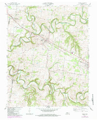
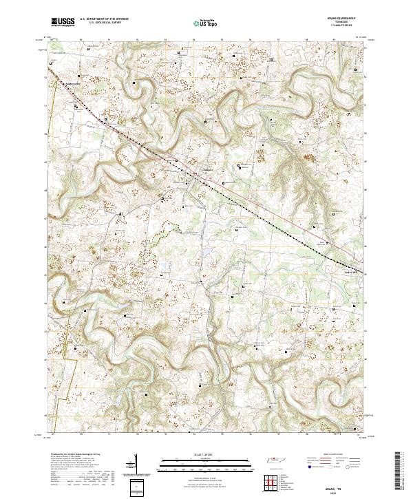
The winding course of the Red River and the Sulphur Fork Red River carve through this Robertson County landscape, defining the layout of rural roads and homesteads. Small settlements like Adams and Sadlersville serve as central nodes for the surrounding agricultural community, where the land is punctuated by numerous family and community burial grounds. The high density of family names attached to these sites, such as the James Johnston Cem, John Bell Cem, and Suggs Cem, provides a significant map for genealogical research, anchoring specific families to their historical landholdings. To the southeast, the terrain transitions toward Cedar Hill, with the rail line and Sturgeon Cr influencing the local geography. The map also identifies local landmarks like Harper Lake and the Fort Wimberly Cem, reflecting a deep layer of localized history preserved in the modern topographic survey.
Find a feature on this map
127 named features on this map. Tap any name to fly to it.
Don’t see what you’re looking for? This feature index may not catch every label — zoom into the map to look around manually.
Map Details
Editions of this 2022 Adams Map
This is the sole edition of this map. No revisions or reprints were ever made.