
Loading...
Loading map...2022 Map of Alamo
USGS Topo · Published 2022About this map
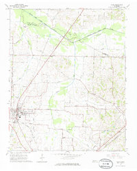
Alamo serves as the seat of justice for Crockett County, centered on the Crockett County Courthouse. This West Tennessee landscape is defined by the winding course of the Middle Fork Forked Deer River, which forms a natural boundary to the north near Horns Bluff and the prehistoric earthworks at Mound Field. The surrounding countryside is dotted with small rural communities and historic crossroads like Quincy, Nance, and Fruitvale.
Find a feature on this map
94 named features on this map. Tap any name to fly to it.
Don’t see what you’re looking for? This feature index may not catch every label — zoom into the map to look around manually.
Map Details
Date Portrayed2022
Date Published2022
PublisherU.S. Geological Survey
Map TypeTopographic
Scale1:24000
Physical Dimensions24 x 29 inches
Editions of this 2022 Alamo Map
This is the sole edition of this map. No revisions or reprints were ever made.
Historical Maps of Porters Grove Through Time
Featured Locations
Source Details
SourceU.S. Geological Survey
CopyrightPublic Domain