
1985 Map of Amboy
USGS Topo · Published 1985About this map
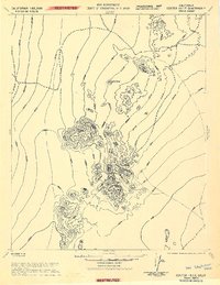
The Atchison Topeka and Santa Fe railroad corridor anchors this mid-1980s look at the high desert, connecting a string of remote outposts from Amboy to Goffs. The landscape is a study in arid geography, defined by broad basins like the Fenner Valley and Clipper Valley sandwiched between prominent ranges such as the Bristol Mountains and Old Woman Mountains. At the southern edge, the expansive dry bed of Bristol Lake sits near the rail line, while to the north, the Devils Playground and Kelso Dunes showcase the shifting sands of the region.
Find a feature on this map
82 named features on this map. Tap any name to fly to it.
Don’t see what you’re looking for? This feature index may not catch every label — zoom into the map to look around manually.
Map Details
Editions of this 1985 Amboy Map
This is the sole edition of this map. No revisions or reprints were ever made.
Other maps of this area

1886 · Camp Mohave
USGS Topo · 1:250,000

1892 · Camp Mohave
USGS Topo · 1:250,000

1910 · Ivanpah
USGS Topo · 1:250,000

1912 · Ivanpah
USGS Topo · 1:250,000

1926 · Mohave City
USGS Topo · 1:96,000

1933 · Avawatz Mountains
USGS Topo · 1:250,000

1942 · Camp Mohave
USGS Topo · 1:250,000

1942 · Ivanpah
USGS Topo · 1:250,000

1942 · Amboy
USGS Topo · 1:250,000
1943 · Center Hills
USGS Topo · 1:62,500