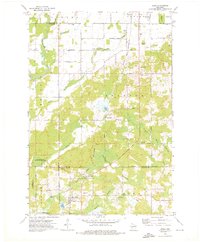
1973 Map of Aniwa
USGS Topo · Published 1976About this map
Aniwa and the surrounding timber and dairy country sits at the convergence of three counties in the early 1970s. The village is a focal point for the Chicago and North Western Railroad, which cuts diagonally across the landscape toward Elmhurst. The terrain is defined by a dense network of water, including the southward-flowing Plover River, the Eau Claire River, and the headwaters of the Middle Branch Embarrass River.
Find a feature on this map
53 named features on this map. Tap any name to fly to it.
Don’t see what you’re looking for? This feature index may not catch every label — zoom into the map to look around manually.
Map Details
Editions of this 1973 Aniwa Map
This is the sole edition of this map. No revisions or reprints were ever made.
Other maps of this area

1899 · Wausau
USGS Topo · 1:125,000

1902 · Wausau
USGS Topo · 1:125,000

1951 · Doering
USGS Topo · 1:48,000

1952 · Antigo
USGS Topo · 1:48,000

1953 · Hatley
USGS Topo · 1:48,000

1954 · Wittenberg
USGS Topo · 1:48,000

1954 · Iron Mountain
USGS Topo · 1:250,000

1955 · Green Bay
USGS Topo · 1:250,000

1959 · Iron Mountain
USGS Topo · 1:250,000

1964 · Wittenberg
USGS Topo · 1:62,500