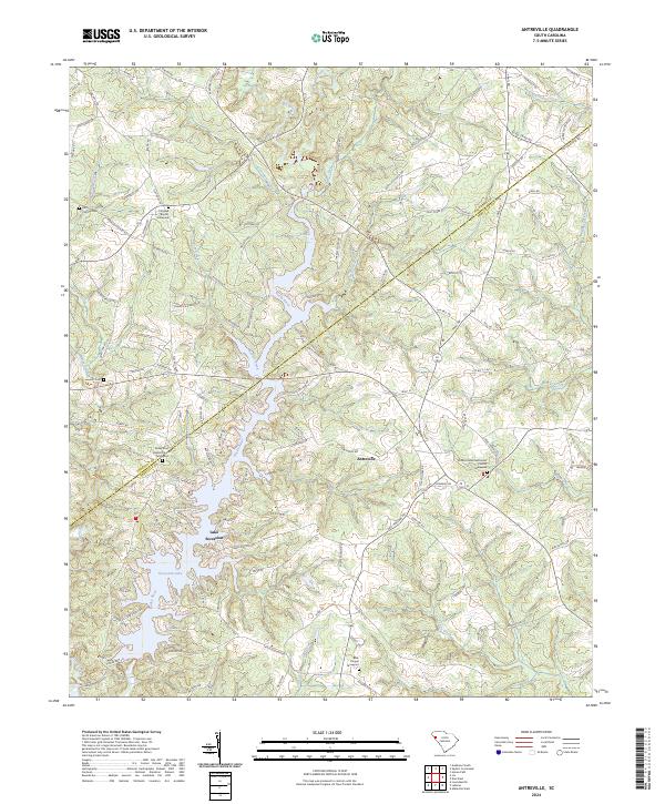
2024 Map of Antreville
USGS Topo · Published 2024About this map
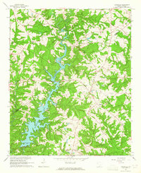
Antreville serves as the central community on this contemporary survey of the borderlands between Abbeville and Anderson Counties. The landscape is dominated by the sprawling reaches of Lake Secession (also labeled Secession Lake) on the Rocky River, where countless finger-like coves and points like Lees Shoals define the local topography. For genealogists, the map is a detailed record of congregational history, featuring several prominent sites including Shiloh United Methodist Church with its Graveyard, Rocky River Baptist Church, and Carswell Baptist Church. Family history researchers can also locate several smaller burial grounds such as Cromer Cem and Leverett Cem, or the Bells Chapel Graveyard at the southern edge of the quadrangle. The intricate network of local roads, such as Asaville Church Rd and Wright School Rd, highlights the rural development patterns that persist around the water's edge.
Find a feature on this map
151 named features on this map. Tap any name to fly to it.
Don’t see what you’re looking for? This feature index may not catch every label — zoom into the map to look around manually.
Map Details
Editions of this 2024 Antreville Map
This is the sole edition of this map. No revisions or reprints were ever made.