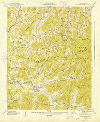
1947 Map of Barnardsville
USGS Topo · Published 1947About this map
The community of Barnardsville serves as the focal point for this 1940s survey, situated where Dillingham Creek and Ivy Creek meet. This mountain landscape is defined by its deep coves and ridge-top boundaries, including the intersection of Madison and Buncombe counties. The area shows a high density of small family cemeteries and rural congregations, such as Antioch Ch and the Big Ivy Cem Barnardsville Ch, which reflect the localized settlement patterns of the Blue Ridge foothills.
Find a feature on this map
161 named features on this map. Tap any name to fly to it.
Don’t see what you’re looking for? This feature index may not catch every label — zoom into the map to look around manually.
Map Details
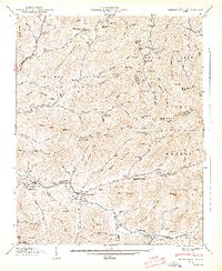
Editions of this 1947 Barnardsville Map
2 editions found
Other maps of this area

1894 · Asheville
USGS Topo · 1:125,000

1900 · Mount Mitchell
USGS Topo · 1:125,000

1901 · Asheville
USGS Topo · 1:125,000

1902 · Mount Mitchell
USGS Topo · 1:125,000

1935 · Montreat
USGS Topo · 1:24,000

1935 · Black Brothers
USGS Topo · 1:24,000

1935 · Burnsville
USGS Topo · 1:24,000

1935 · Bald Creek
USGS Topo · 1:24,000

1935 · Barnardsville
USGS Topo · 1:24,000

1935 · Craggy Pinnacle
USGS Topo · 1:24,000