2025 Map of Bayport
USGS Topo · Published 2025About this map
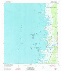
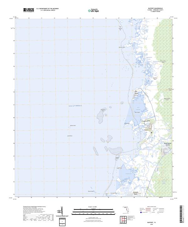
The Gulf of Mexico coastline in Hernando County is defined by a complex network of salt marshes and tidal creeks, where the Weeki Wachee River and Mud River meet the sea. This coastal landscape features a series of named hammocks and islands, including Eagle Nest Island, Sawmill Island, and Wagon Wheel Island, scattered throughout the Chassahowitzka Swamp. Small residential settlements such as Bayport and Cooglers Beach occupy the few stable points of land along the marsh edge, while the more developed Weeki Wachee Gardens and Hernando Beach show the modern expansion of canal-front communities.
Find a feature on this map
46 named features on this map. Tap any name to fly to it.
Don’t see what you’re looking for? This feature index may not catch every label — zoom into the map to look around manually.
Map Details
Editions of this 2025 Bayport Map
This is the sole edition of this map. No revisions or reprints were ever made.