2021 Map of Belden
USGS Topo · Published 2021About this map
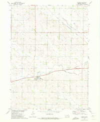
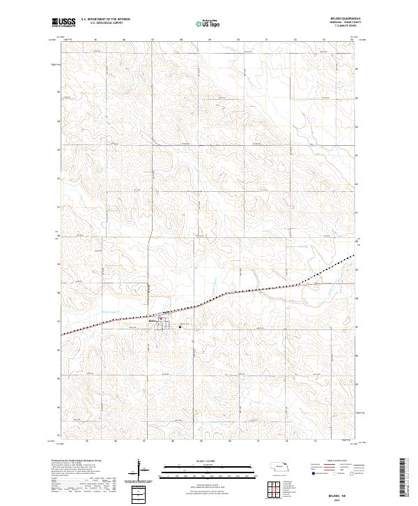
Belden serves as the central hub of this Cedar County landscape, situated along the upper reaches of Middle Logan Cr. The settlement is defined by a grid of streets including Nebraska St, Cedar St, and Dodge St, with the Belden Cem located just to the southeast. The surrounding terrain is heavily partitioned by a precise network of section-line roads, such as 870th Rd and 567th Ave, reflecting the enduring structure of the Public Land Survey System in northeast Nebraska. While the town anchors the southern portion of the sheet, the northern reaches are defined by the winding paths of Perrin Cr and Baker Cr, illustrating the drainage patterns that shaped the region's agricultural development. This survey captures the rural character of the area, where the intersection of watercourses and township boundaries creates a distinct patchwork of lowland basins and upland plains.
Find a feature on this map
28 named features on this map. Tap any name to fly to it.
Don’t see what you’re looking for? This feature index may not catch every label — zoom into the map to look around manually.
Map Details
Editions of this 2021 Belden Map
This is the sole edition of this map. No revisions or reprints were ever made.