2021 Map of Bell City
USGS Topo · Published 2021About this map
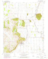
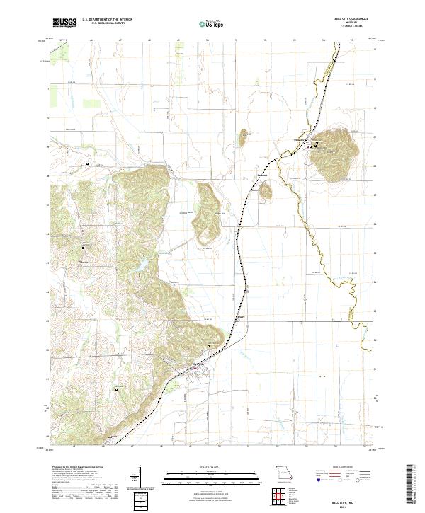
Bell City serves as the focal point of this region in Southeast Missouri, situated at the edge of the rising terrain that characterizes the western portion of the map. The landscape transitions sharply from the low, water-carved bottomlands of the Little River and Mill Slough to the prominent elevations of Bird Hill, Cow Hill, and Lost Hill. This geological variation heavily influenced local settlement patterns, with communities like Perkins and Painton clustered near the foot of these hills. For genealogists, the map is particularly rich in family history markers, documenting numerous burial grounds such as Plainview Cem, Thomas Cem, and Pleasant Hill Cem. The intricate drainage network, including Ash Slough and Crooked Slough, illustrates the complex hydrology of the bootheel region's western edge.
Find a feature on this map
72 named features on this map. Tap any name to fly to it.
Don’t see what you’re looking for? This feature index may not catch every label — zoom into the map to look around manually.
Map Details
Editions of this 2021 Bell City Map
This is the sole edition of this map. No revisions or reprints were ever made.