2024 Map of Bluffton
USGS Topo · Published 2024About this map
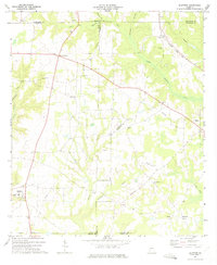
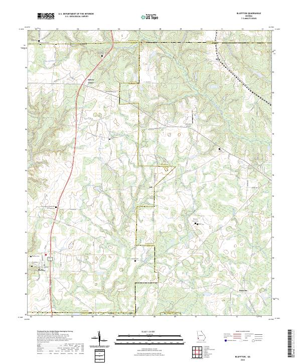
Bluffton anchors the southwestern corner of this West Georgia landscape, situated at the junction of several local routes like Pine St and Kolomoki Rd. The terrain is defined by a dense network of tributaries including Little Pachitla Creek, Spring Creek, and Williams Creek, which drain a patchwork of agricultural lands and wooded creek bottoms. Small crossroads and named locales such as Suttons Corner, Jeff, and Parksville highlight the area's rural settlement patterns, while the McLendon Airport serves as a modern waypoint. Genealogists and local historians will find significant value in the numerous burial sites and houses of worship distributed across the quadrangle, from the Union African Methodist Episcopal Cem to smaller family-named plots like Mills Cem and Vincent Cem. The map clearly delineates the intersecting borders of Clay, Randolph, Calhoun, and Early counties, tracing how administrative lines follow both natural features and straight-line surveys.
Find a feature on this map
87 named features on this map. Tap any name to fly to it.
Don’t see what you’re looking for? This feature index may not catch every label — zoom into the map to look around manually.
Map Details
Editions of this 2024 Bluffton Map
This is the sole edition of this map. No revisions or reprints were ever made.