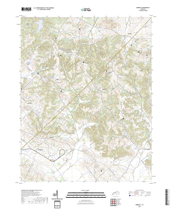
2022 Map of Bordley
USGS Topo · Published 2022About this map
Bordley and Hearin anchor the western reaches of this Webster County landscape, where the terrain transitions from the Sulphur Spring Hills down toward the drainage of Bordley Ditch. The area is defined by its numerous family burial grounds and small community centers, such as the Old Chalybeate Springs Methodist Church Cem and Waggoner Church Cem. Transportation through these ridges is dictated by the local topography, with Airline-Bordley Rd and State Rte 2153 connecting the various settlements.
Find a feature on this map
94 named features on this map. Tap any name to fly to it.
Don’t see what you’re looking for? This feature index may not catch every label — zoom into the map to look around manually.
Map Details
Editions of this 2022 Bordley Map
This is the sole edition of this map. No revisions or reprints were ever made.
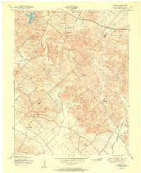
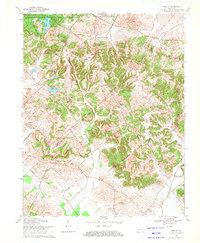
Historical Maps of Free Union Through Time
3 maps found