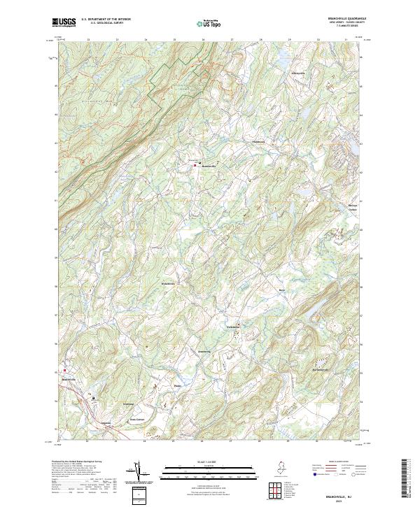
2023 Map of Branchville
USGS Topo · Published 2023About this map
Kittatinny Mtn and the winding Appalachian National Scenic Trl dominate the western highlands of this Sussex County landscape, while the valley floor is defined by the Wallkill River National Wildlife Refuge. The settlement pattern follows the drainage of the Papakating Creek and its tributaries, with small hamlets like Beemerville, Wykertown, and Pellettown linked by a network of country roads such as Deckertown Tpke. In the southwest, the borough of Branchville serves as a local hub near the Paulins Kill, supported by infrastructure like the Branchville Reservoir and the Branchville Cem. Significant elevation changes between Sunrise Mtn and the alluvial plains of Harmonyvale illustrate the geological transition from the high ridges to the fertile agricultural bottomlands that have sustained these communities for generations.
Find a feature on this map
115 named features on this map. Tap any name to fly to it.
Don’t see what you’re looking for? This feature index may not catch every label — zoom into the map to look around manually.
Map Details
Editions of this 2023 Branchville Map
This is the sole edition of this map. No revisions or reprints were ever made.
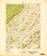
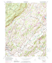
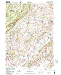
Historical Maps of Augusta Through Time
4 maps found