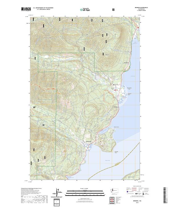
2023 Map of Brinnon
USGS Topo · Published 2023About this map
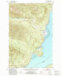
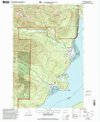
Brinnon and Duckabush serve as the primary coastal gateways to the eastern slopes of the Olympic Mountains, where the Dosewallips River and Duckabush River meet the salt waters of Hood Canal. This 2023 survey illustrates the modern interface between the Olympic National Forest and the residential developments clustered along the shoreline. The geography is defined by deep maritime inlets and steep timbered ridges, with features like Dabob Bay and Pleasant Harbor providing sheltered waters against the high terrain of Mt Turner and Green Hill.
Find a feature on this map
75 named features on this map. Tap any name to fly to it.
Don’t see what you’re looking for? This feature index may not catch every label — zoom into the map to look around manually.
Map Details
Editions of this 2023 Brinnon Map
This is the sole edition of this map. No revisions or reprints were ever made.
Historical Maps of Lackawanna Beach Through Time
3 maps found