2021 Map of Broseley
USGS Topo · Published 2021About this map
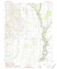
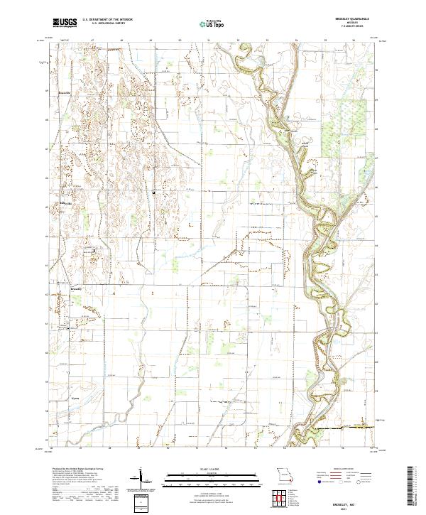
The Saint Francis River serves as the eastern boundary for this part of Butler County, winding through a landscape defined by an extensive drainage system. Historically reliant on the management of wetlands, the area is crisscrossed by numerous channels including Ditch Number 16 and Ditch Number 21. These engineering efforts supported the growth of small agricultural hubs such as Broseley, Rossville, and Batesville. The map captures several family and community landmarks, most notably Browns Chapel Cem, Mole Hill Cem, and Vale Cem, which offer significant value for genealogical research in this region of the Missouri Bootheel. Along the river, natural river features like Upper Shoals and Lower Shoals suggest the historical navigation challenges and local fishing spots that once defined river life before modern channelization.
Find a feature on this map
67 named features on this map. Tap any name to fly to it.
Don’t see what you’re looking for? This feature index may not catch every label — zoom into the map to look around manually.
Map Details
Editions of this 2021 Broseley Map
This is the sole edition of this map. No revisions or reprints were ever made.