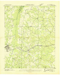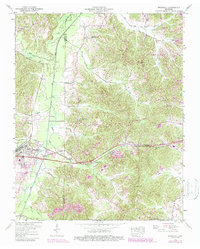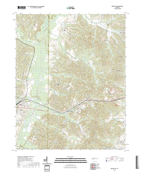
2022 Map of Bruceton
USGS Topo · Published 2022About this map
The Big Sandy River forms a significant natural boundary on this map, separating Carroll and Benton Counties as it flows northward through West Tennessee. The landscape is defined by its complex hydrology, with numerous winding tributaries like Hunting Creek, Watson Cr, and Smuthers Cr feeding into the river valley. The town of Bruceton serves as a primary settlement hub in the west, characterized by its grid-style residential streets such as Chestnut St S and Cheatham St, while smaller rural communities like Sawyers Mill, Sandy Point, and Post Oak are scattered throughout the eastern hills. Local industrial and land-use history is visible through features like the Hardy Sand Company Lake and the Benton County Airport in the southeast. Genealogists will find several family and community burial grounds, including Parks Cem, Mount Carmel Cem, and Greer Cem, which provide a clear record of the local population distribution across this rural corridor.
Find a feature on this map
106 named features on this map. Tap any name to fly to it.
Don’t see what you’re looking for? This feature index may not catch every label — zoom into the map to look around manually.
Map Details
Editions of this 2022 Bruceton Map
This is the sole edition of this map. No revisions or reprints were ever made.
Historical Maps of Sawyers Mill Through Time
3 maps found