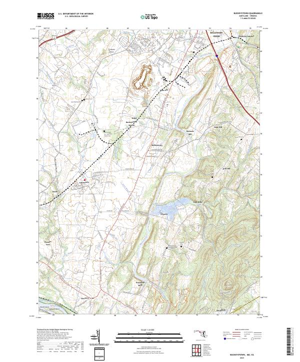
2023 Map of Buckeystown
USGS Topo · Published 2023About this map
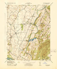
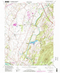
Monocacy National Battlefield occupies the northeastern reaches of this landscape, marking where the Monocacy River winds through the Maryland countryside near Frederick Junction. The river valley acts as a central artery for the region, bordered by agricultural settlements and industrial remnants like Michaels Mill and Greenfield Mills. The Chesapeake and Ohio Canal parallels the Potomac River at the southern edge, illustrating the area's deep ties to historic transport corridors. Moving inland, the terrain rises toward the base of Sugar Loaf Mtn, with the vast Lily Pons Fish Ponds and Lilypons creating a distinctive aquatic footprint in the center of the map. Genealogical interests are well-represented by several community burial grounds, including Saint Joseph-On-Carrollton Manor Cem and the Koontz Chapel United Methodist Church Cem, which anchor the long-standing rural hamlets of Buckeystown and Adamstown.
Find a feature on this map
135 named features on this map. Tap any name to fly to it.
Don’t see what you’re looking for? This feature index may not catch every label — zoom into the map to look around manually.
Map Details
Editions of this 2023 Buckeystown Map
This is the sole edition of this map. No revisions or reprints were ever made.
Historical Maps of Mathews Through Time
3 maps found