Loading...
Loading map...2021 Map of Burbank
USGS Topo · Published 2021About this map
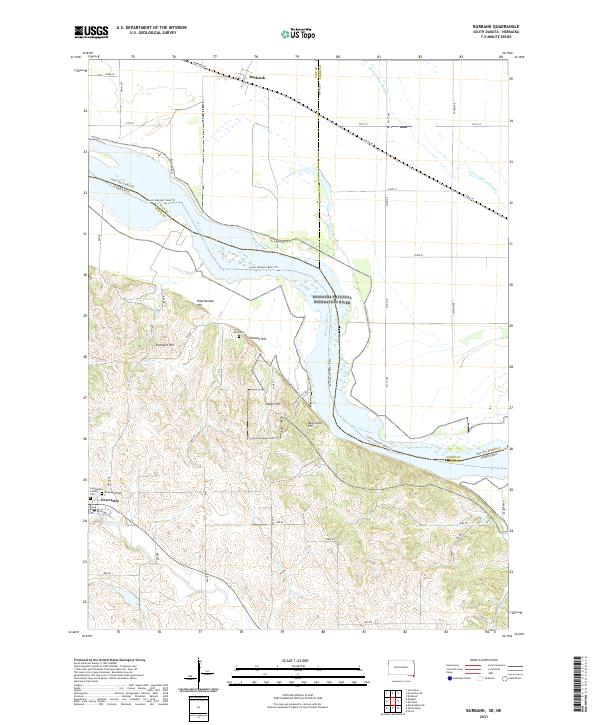
The Missouri River forms the central character of this landscape, acting as a broad, shifting border between South Dakota and Nebraska. Along its northern banks, the village of Burbank sits on a level plain crisscrossed by modern local roads like Burbank Rd and 321st St. This area is characterized by significant conservation efforts, notably within the Union County Waterfowl Production Area and the protected stretches of the Missouri National Recreation River.
Find a feature on this map
47 named features on this map. Tap any name to fly to it.
Don’t see what you’re looking for? This feature index may not catch every label — zoom into the map to look around manually.
Map Details
Date Portrayed2021
Date Published2021
PublisherU.S. Geological Survey
Map TypeTopographic
Scale1:24000
Physical Dimensions24 x 29 inches
Editions of this 2021 Burbank Map
This is the sole edition of this map. No revisions or reprints were ever made.
Historical Maps of Elk Point Township Through Time

Featured Locations
- Elk Point Township, SD
- Brule Township, SD
- Lembke Landing, Newcastle Township
- Newcastle, Newcastle Township
- Burbank, Fairview Township
Source Details
SourceU.S. Geological Survey
CopyrightPublic Domain