2022 Map of Callaway
USGS Topo · Published 2022About this map
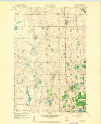
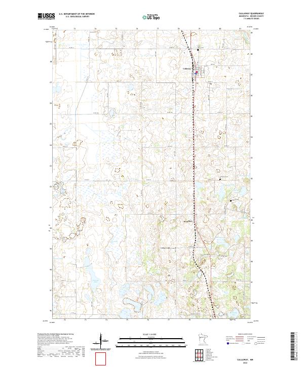
The BNSF Railway corridor serves as the primary north-south spine for this portion of Becker County, connecting the established community of Callaway with the small cluster of Westbury. This landscape is defined by its dense concentration of glacial lakes and wetlands, where water bodies like Pierce Lake, Cravath Lake, and Harding Lake dominate the terrain. The presence of historic burial grounds, including Saint Marys Cem north of town and Richwood Cem to the east, provides essential reference points for genealogists tracking early families in this lake-rich region. The Buffalo River makes a brief appearance in the northeast corner, while a grid of county roads, such as Co RD 14 and Co RD 12, facilitates movement between the numerous family farms and waterfront properties that characterize this rural Minnesota environment.
Find a feature on this map
55 named features on this map. Tap any name to fly to it.
Don’t see what you’re looking for? This feature index may not catch every label — zoom into the map to look around manually.
Map Details
Editions of this 2022 Callaway Map
This is the sole edition of this map. No revisions or reprints were ever made.