
Loading...
Loading map...2022 Map of Capulin
USGS Topo · Published 2022About this map
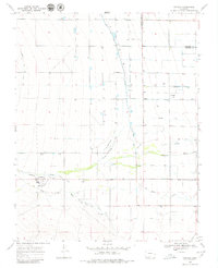
Capulin serves as the primary hub of this high-altitude valley, situated along the Alamosa River and surrounded by a complex system of irrigation infrastructure. The settlement's history is preserved at the Saint Joseph Church Old Cem and the Old Capulin Cem, reflecting generations of local family lineage. To the northeast, the smaller community of Morgan sits near the Morganville Ditch and Morgan Drain, marking the agrarian character of the border between Alamosa and Conejos Counties.
Find a feature on this map
44 named features on this map. Tap any name to fly to it.
Don’t see what you’re looking for? This feature index may not catch every label — zoom into the map to look around manually.
Map Details
Date Portrayed2022
Date Published2022
PublisherU.S. Geological Survey
Map TypeTopographic
Scale1:24000
Physical Dimensions24 x 29 inches
Editions of this 2022 Capulin Map
This is the sole edition of this map. No revisions or reprints were ever made.
Historical Maps of Morgan Through Time
Featured Locations
Source Details
SourceU.S. Geological Survey
CopyrightPublic Domain