2024 Map of Caraway
USGS Topo · Published 2024About this map
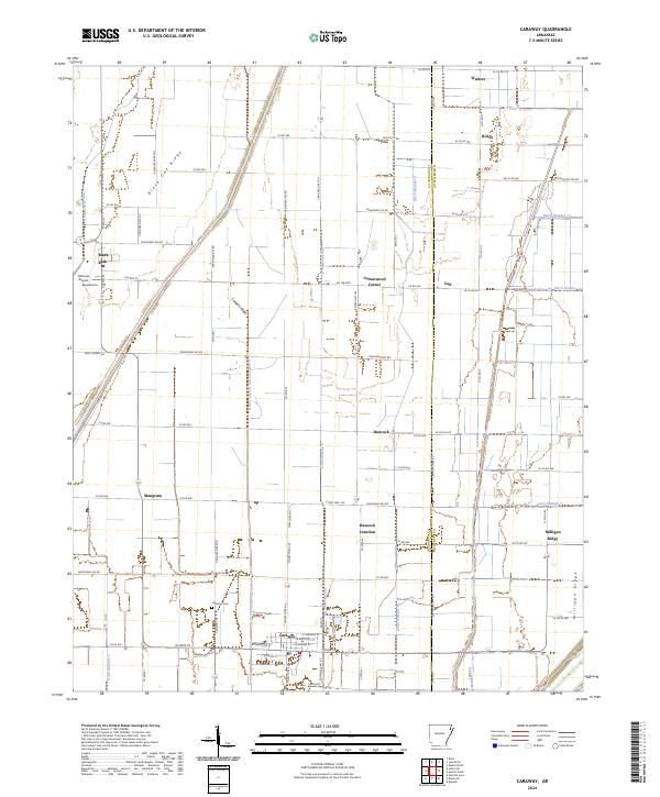
Caraway and Black Oak anchor this landscape along the border of Craighead Co and Mississippi Co. The area is defined by an extensive network of drainage infrastructure, such as Honey Cypress Ditch Number 4 and Little Slough Ditch, which converted former wetlands into a productive agricultural grid. These man-made channels intersect the natural elevations of Black Oak Ridge, Coopers Ridge, and Milligan Ridge, where early settlements were established to avoid seasonal flooding. Local civic life is concentrated south in Caraway, home to the Caraway Schools and Caraway Cem. Further north, smaller crossroads like Cottonwood Corner and Hancock Junction demonstrate the dispersed nature of this rural community. The presence of Hickman Airport west of Black Oak suggests the continued importance of aerial crop dusting in this intensive farming region.
Find a feature on this map
92 named features on this map. Tap any name to fly to it.
Don’t see what you’re looking for? This feature index may not catch every label — zoom into the map to look around manually.
Map Details
Editions of this 2024 Caraway Map
This is the sole edition of this map. No revisions or reprints were ever made.