2023 Map of Chelsea
USGS Topo · Published 2023About this map
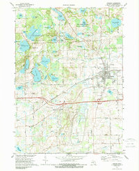
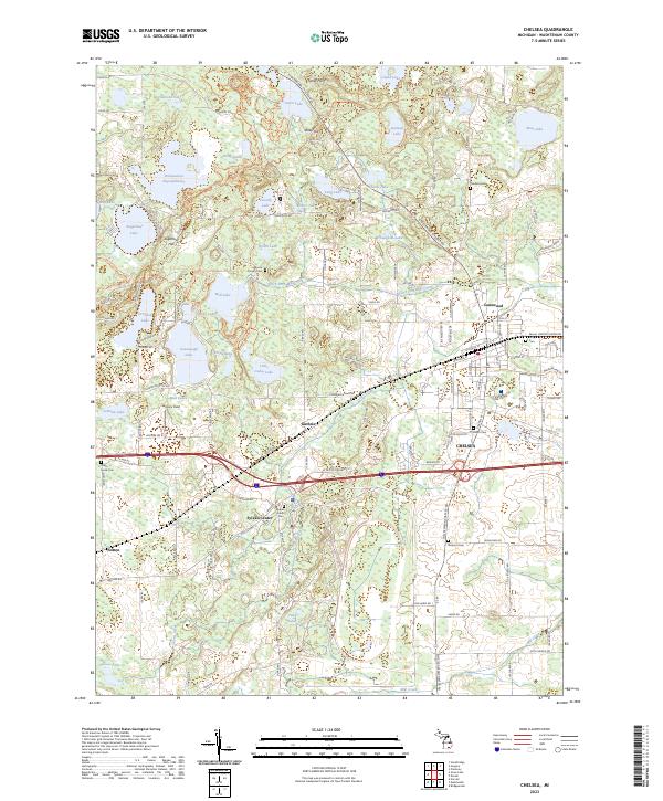
Chelsea serves as the primary hub of this landscape, where the street grid meets the path of Letts Creek. This 2023 survey illustrates a region defined by its glacial kettle lakes and wetland basins, including Winnewana Lake, Cavanaugh Lake, and the wide Winnewana Impoundment. The western portion of the map is dominated by the Waterloo Rec Area, showing the Waterloo-Pinckney Hiking Trl winding through high points like Sugarloaf Hill and Riley Hill. Genealogists will find several burial grounds across the township, such as Maple Grove Cem near Sylvan Center and Salem Grove Cem to the south. Small named locales like Guthrie, Lanewood, and Notten provide specific reference points for local history researchers tracing the development of Washtenaw County's rural corridors along Old US Hwy 12 and the interstate.
Find a feature on this map
123 named features on this map. Tap any name to fly to it.
Don’t see what you’re looking for? This feature index may not catch every label — zoom into the map to look around manually.
Map Details
Editions of this 2023 Chelsea Map
This is the sole edition of this map. No revisions or reprints were ever made.