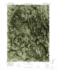
1975 Map of Chester
USGS Topo · Published 1981About this map
West Branch Westfield River and its tributaries carve a network of steep-sided valleys through this section of the Berkshire foothills during the mid-1970s. This orthophotoquad, produced from 1975 aerial photography, reveals the precise footprint of human settlement in relation to the complex hydrology of the region. The village of Chester sits at the confluence of the West Branch and several smaller streams, while Chester Center occupies a higher plateau to the east. The landscape is dominated by the newly created Littleville Lake on the Little River, a prominent feature that altered the valley south of South Worthington. Higher elevations in the northern portion of the map near Ringville show the dense forest cover and agricultural clearings of the Middle Branch Westfield River valley, providing a clear record of land use before later reforestation and development.
Find a feature on this map
8 named features on this map. Tap any name to fly to it.
Don’t see what you’re looking for? This feature index may not catch every label — zoom into the map to look around manually.
Map Details
Editions of this 1975 Chester Map
This is the sole edition of this map. No revisions or reprints were ever made.
Other maps of this area

1886 · Chesterfield
USGS Topo · 1:62,500

1886 · Becket
USGS Topo · 1:62,500

1887 · Granville
USGS Topo · 1:62,500

1888 · Becket
USGS Topo · 1:62,500

1888 · Sandisfield
USGS Topo · 1:62,500

1888 · Chesterfield
USGS Topo · 1:62,500

1889 · Granville
USGS Topo · 1:62,500

1893 · Granville
USGS Topo · 1:62,500

1893 · Chesterfield
USGS Topo · 1:62,500

1893 · Becket
USGS Topo · 1:62,500