Loading...
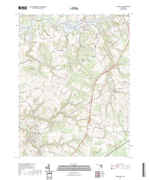
Loading map...2023 Map of Church Hill
USGS Topo · Published 2023About this map
The Chester River forms the northern boundary of this Maryland landscape, where the border between Kent Co and Queen Anne's Co follows the water. The settlement of Church Hill anchors the southwestern portion of the map, characterized by a grid of local roads like Main St and Walnut St leading toward the Church Hill Cem. To the north, the town of Crumpton sits near the riverbanks, serving as a historic crossing point near Sutton Point and Chase Island.
Find a feature on this map
44 named features on this map. Tap any name to fly to it.
Don’t see what you’re looking for? This feature index may not catch every label — zoom into the map to look around manually.
Map Details
Date Portrayed2023
Date Published2023
PublisherU.S. Geological Survey
Map TypeTopographic
Scale1:24000
Physical Dimensions24 x 29 inches
Editions of this 2023 Church Hill Map
This is the sole edition of this map. No revisions or reprints were ever made.
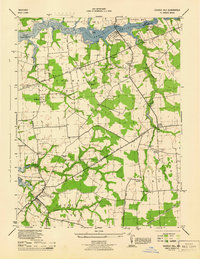
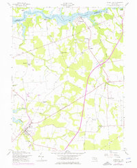
Historical Maps of Stevens Corner Through Time
3 maps found
Featured Locations
Source Details
SourceU.S. Geological Survey
CopyrightPublic Domain