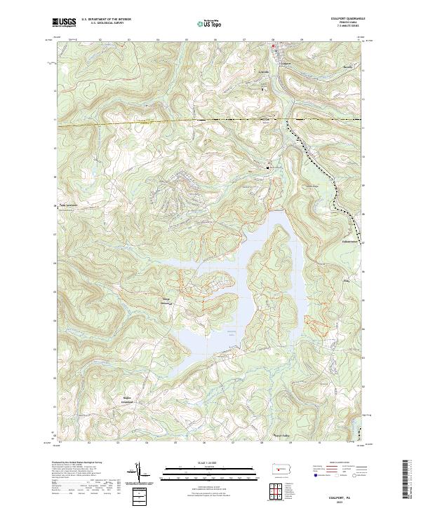
2023 Map of Coalport
USGS Topo · Published 2023About this map
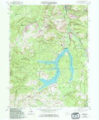
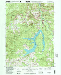
Glendale Lake dominates the central landscape of this western Pennsylvania region, where the borders of Clearfield Co and Cambria Co meet. The terrain is defined by a dense network of waterways, including Clearfield Creek and Beaverdam Run, which carve through the high ground of Snake Ridge. This area is characterized by scattered small settlements and traditional crossroads, such as Longs Crossroad and Nagles Crossroad, reflecting a rural development pattern common to the Allegheny Plateau.
Find a feature on this map
97 named features on this map. Tap any name to fly to it.
Don’t see what you’re looking for? This feature index may not catch every label — zoom into the map to look around manually.
Map Details
Editions of this 2023 Coalport Map
This is the sole edition of this map. No revisions or reprints were ever made.
Historical Maps of Reade Township Through Time
3 maps found