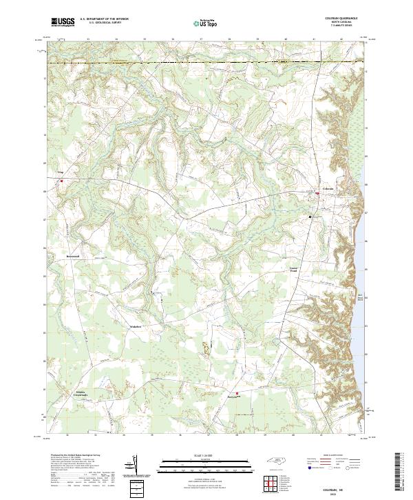
2022 Map of Colerain
USGS Topo · Published 2022About this map
The town of Colerain and its surrounding rural hamlets define this coastal plain landscape near the Hertford-Bertie county line. The area's hydrology is dominated by extensive wetlands, including Chinkapin Swamp, Cypress Swamp, and Barbeque Swamp, which wind between family-named farm roads and small crossroads settlements. These drainage patterns influenced the placement of early communities like Trap, Rosemead, and Wakelon, where the topography rises slightly above the swampy lowlands. Near the shoreline, Goose Pond and Bull Pond Point sit just inland from the river's edge, while Hickory Ridge provides a distinct change in elevation. For those looking for local landmarks, Hillcrest Cem is located south of the main village. The network of local routes, such as Valentine Farm Rd and Nowell Farm Rd, highlights the agricultural heritage of this Bertie County corridor.
Find a feature on this map
67 named features on this map. Tap any name to fly to it.
Don’t see what you’re looking for? This feature index may not catch every label — zoom into the map to look around manually.
Map Details
Editions of this 2022 Colerain Map
This is the sole edition of this map. No revisions or reprints were ever made.
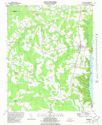
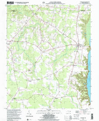
Historical Maps of Trap Through Time
3 maps found