2023 Map of Conneautville
USGS Topo · Published 2023About this map
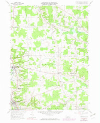
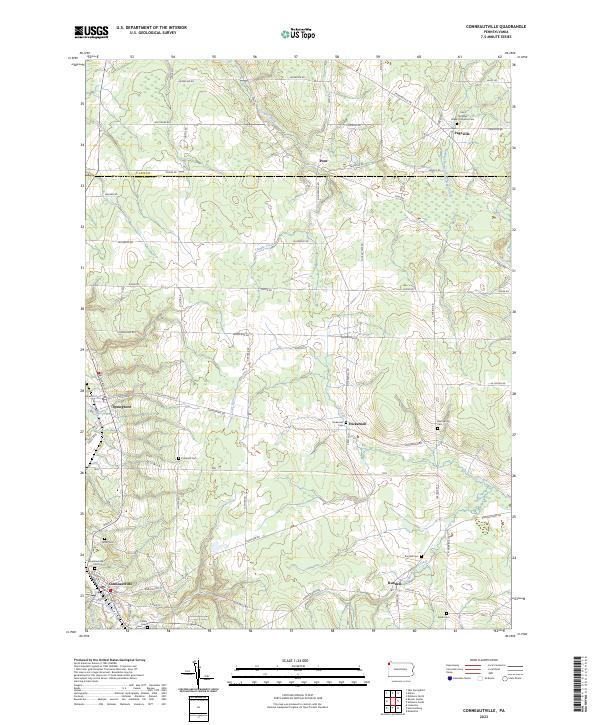
Conneautville and Springboro anchor the southern reaches of this landscape, where the waters of Conneaut Creek and Cussewago Creek dictate the local geography. The map documents a predominantly rural and agricultural layout in modern Crawford County, defined by a network of small settlements like Hickernell, Rundell, and Pont. For genealogists and local historians, the sheet is particularly dense with small family and community burial grounds, including the Coblentz Cem, Foster Cem, and the Saint Nicholas Greek Orthodox Cem near Pageville. The terrain is drained by numerous winding waterways such as Carr Run and Temple Creek, which run through a patchwork of fields and woodlots. This survey provides a precise account of the property access and residential patterns that have persisted along the Erie Co Crawford Co line into the 2020s.
Find a feature on this map
52 named features on this map. Tap any name to fly to it.
Don’t see what you’re looking for? This feature index may not catch every label — zoom into the map to look around manually.
Map Details
Editions of this 2023 Conneautville Map
This is the sole edition of this map. No revisions or reprints were ever made.