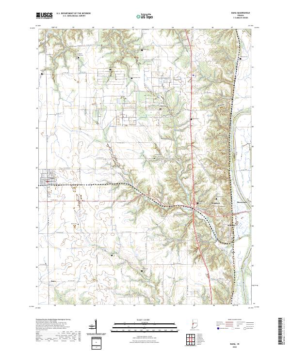
2022 Map of Dana
USGS Topo · Published 2022About this map
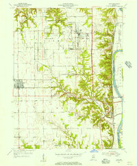
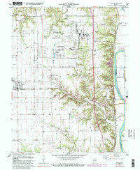
Dana occupies the western portion of this Vermillion County landscape, situated amidst a grid of rural roads and scattered farmsteads. The eastern boundary is defined by the winding course of the Wabash River, which separates Vermillion and Parke counties. Between these landmarks, the terrain is shaped by the drainage of Little Raccoon Cr and Buck Cr, creating a series of wooded valleys and ridges. Smaller settlements like Highland, Hillsdale, and Alta are concentrated near the river corridor, while Bono sits to the southwest.
Find a feature on this map
88 named features on this map. Tap any name to fly to it.
Don’t see what you’re looking for? This feature index may not catch every label — zoom into the map to look around manually.
Map Details
Editions of this 2022 Dana Map
This is the sole edition of this map. No revisions or reprints were ever made.
Historical Maps of Early Station Through Time
3 maps found