2022 Map of Darwin
USGS Topo · Published 2022About this map
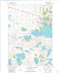
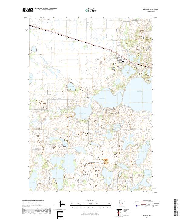
Darwin and the small settlement of Casey anchor this portion of Meeker County, characterized by a complex network of glacial lakes and wetlands. The landscape is dominated by large water bodies such as Lake Stella, Manuella Lake, and Lake Washington, which are connected by waterways like Washington Cr. This map reveals a transition from the edges of Litchfield into a rural expanse defined by section-line roads such as 250th ST and Co RD 14. Local history and genealogy are grounded in several established burial sites, including the Ellsworth Cem, Saint Johns Cem, and All Saints Lutheran Cem. The presence of Rice City Cir near the northeast corner of Lake Darwin suggests a distinct residential or historic development pattern amidst the surrounding agricultural fields and lakefront properties.
Find a feature on this map
70 named features on this map. Tap any name to fly to it.
Don’t see what you’re looking for? This feature index may not catch every label — zoom into the map to look around manually.
Map Details
Editions of this 2022 Darwin Map
This is the sole edition of this map. No revisions or reprints were ever made.