2022 Map of Denton
USGS Topo · Published 2022About this map
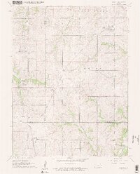
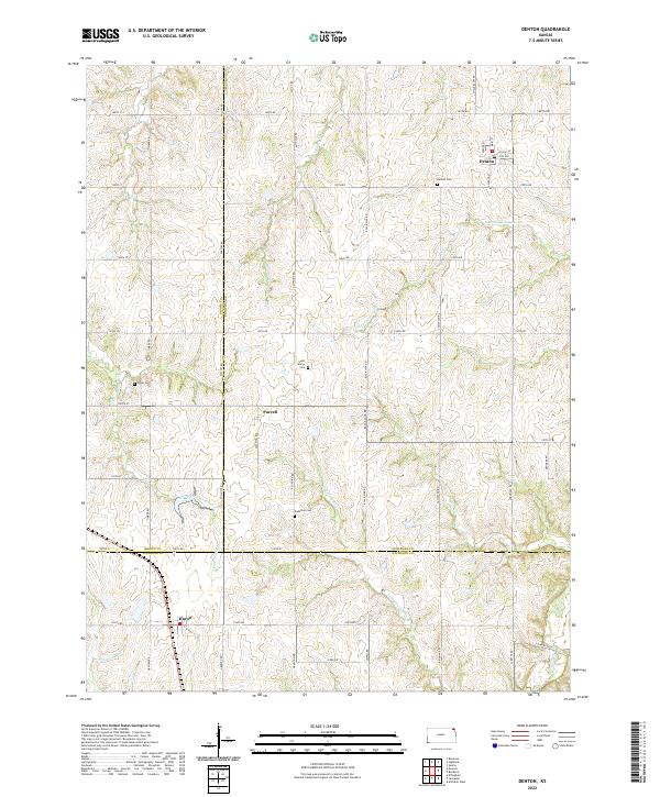
Denton serves as a focal point in this northeast Kansas landscape, where the town's street grid, including Main St and Ashland St, meets the open agricultural expanse of Doniphan Co. The terrain is defined by the dendritic drainage patterns of Halling Cr and the South Fork Wolf River, which carve through the high plains. Small rural clusters like Purcell and Huron are connected by a rigorous section-line road network, including Ash Point Rd and Black Jack Rd. Genealogy researchers will find several well-preserved burial grounds, such as Saint Mary's Cem and Anderson Cem, which remain as anchor points for the area's long-established farmsteads. The map clearly illustrates the transition of jurisdictions where Brown, Doniphan, and Atchison counties converge, reflecting the enduring local administrative boundaries of the region.
Find a feature on this map
55 named features on this map. Tap any name to fly to it.
Don’t see what you’re looking for? This feature index may not catch every label — zoom into the map to look around manually.
Map Details
Editions of this 2022 Denton Map
This is the sole edition of this map. No revisions or reprints were ever made.