2023 Map of Emlenton
USGS Topo · Published 2023About this map
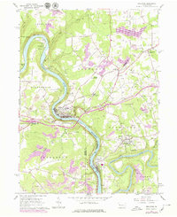
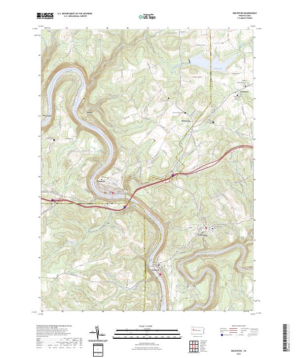
The Allegheny River carves a dramatic oxbow through this corner of Pennsylvania, defining the geography of the riverfront boroughs and the multi-county border. The borough of Emlenton sits at the base of this major bend, where the Middle Allegheny River Water Trl follows the natural flow past the Emlenton Cem. To the south, the Clarion River joins the Allegheny near the village of Foxburg, a point where Clarion, Butler, and Armstrong counties meet. This modern survey illustrates the persistent importance of these river corridors for both recreation and historical settlement patterns.
Find a feature on this map
106 named features on this map. Tap any name to fly to it.
Don’t see what you’re looking for? This feature index may not catch every label — zoom into the map to look around manually.
Map Details
Editions of this 2023 Emlenton Map
This is the sole edition of this map. No revisions or reprints were ever made.