2022 Map of Epworth
USGS Topo · Published 2022About this map
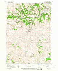
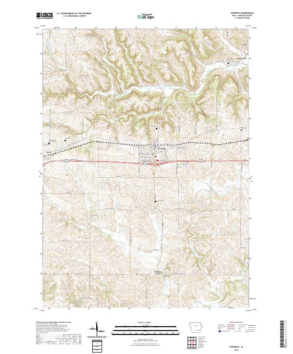
Epworth and Farley anchor this portion of Dubuque County, where the agricultural uplands are deeply incised by the Little Maquoketa River and Whitewater Cr. The landscape is a mix of traditional farmstead layouts and religious institutions, most notably the Divine Word College campus and several historic churchyards like Saint Patricks Cem. This 2022 survey captures the modern alignment of major roads like Freedom Rd alongside preserved corridors such as the Heritage Trl, which follows a former railroad grade through the rolling hills. Genealogists will find an exceptional density of family and parish burial sites, from the Lattnerville Catholic Cem in the north to the Saint Johns Cem near Pleasant Grove in the south. The small hamlets of Graf and Lattnerville remain as distinct points of reference in a region defined by its long-standing Catholic heritage and river-carved topography.
Find a feature on this map
85 named features on this map. Tap any name to fly to it.
Don’t see what you’re looking for? This feature index may not catch every label — zoom into the map to look around manually.
Map Details
Editions of this 2022 Epworth Map
This is the sole edition of this map. No revisions or reprints were ever made.