2021 Map of Essex
USGS Topo · Published 2021About this map
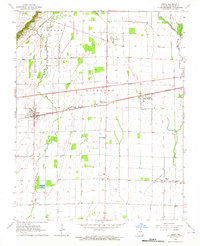
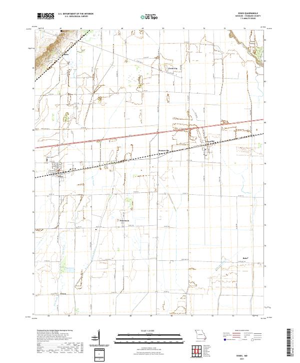
Essex serves as the primary hub of this Missouri landscape, situated within a grid of agricultural lands and water management features. The area's history is tied to the drainage of the Bootheel, evidenced by the channelized paths of Bess Slough and Lateral Number 4, which cut across the low-lying terrain to manage the flow toward the Upper Castor River. These watercourses define the layout of surrounding farmsteads and the small communities that emerged along regional corridors, such as Circle City and Grayridge.
Find a feature on this map
66 named features on this map. Tap any name to fly to it.
Don’t see what you’re looking for? This feature index may not catch every label — zoom into the map to look around manually.
Map Details
Editions of this 2021 Essex Map
This is the sole edition of this map. No revisions or reprints were ever made.