Loading...
Loading map...2022 Map of Fairfield
USGS Topo · Published 2022About this map
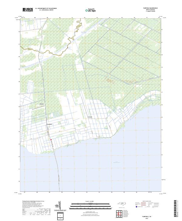
Fairfield and the neighboring settlement of Carmur sit at the intersection of land and water in this low-lying coastal landscape. Defined by an extensive network of drainage and transport waterways, the area is bounded to the south by the northern reaches of Lake Mattamuskeet and to the north by the Alligator River. The Intracoastal Waterway and the Pungo River Alligator River Canal highlight the region's importance for maritime transit through Hyde County.
Find a feature on this map
25 named features on this map. Tap any name to fly to it.
Don’t see what you’re looking for? This feature index may not catch every label — zoom into the map to look around manually.
Map Details
Date Portrayed2022
Date Published2022
PublisherU.S. Geological Survey
Map TypeTopographic
Scale1:24000
Physical Dimensions24 x 29 inches
Editions of this 2022 Fairfield Map
This is the sole edition of this map. No revisions or reprints were ever made.
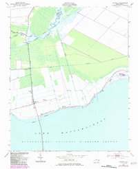
Historical Maps of Carmur Through Time
Featured Locations
Source Details
SourceU.S. Geological Survey
CopyrightPublic Domain