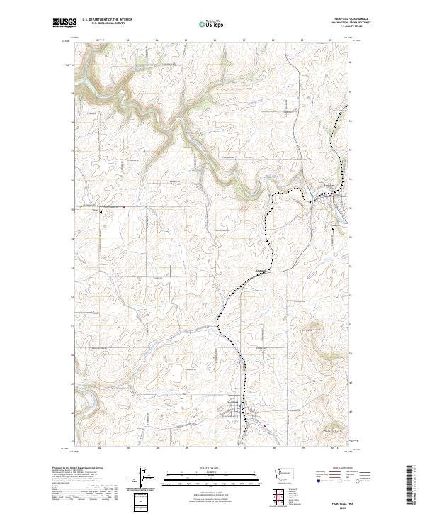
2023 Map of Fairfield
USGS Topo · Published 2023About this map
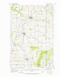
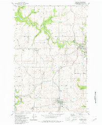
Fairfield and Rockford serve as the primary hubs in this corner of Spokane County, where the agricultural landscape is defined by the drainage patterns of Rock Creek and Hangman Creek. The map documents a rural environment characterized by prominent elevations such as Morefield Butte and Hansen Butte, which rise above a network of section-line roads and named lanes like E Rattlers Run Rd and S Mount Hope Rd. Local history and genealogy are anchored by established sites like Mount Hope Cem and Fairview Cem, while the small settlement of Darknell occupies the central portion of the quadrangle. The intricate hydrography, including Mica Creek and Deadman Creek, illustrates how the Palouse-adjacent terrain has been managed and settled, with the township and range boundaries of t23n r44e and t22n r45e providing the structural grid for this productive farming region.
Find a feature on this map
62 named features on this map. Tap any name to fly to it.
Don’t see what you’re looking for? This feature index may not catch every label — zoom into the map to look around manually.
Map Details
Editions of this 2023 Fairfield Map
This is the sole edition of this map. No revisions or reprints were ever made.
Historical Maps of Spokane County Through Time
3 maps found