2022 Map of Fall River
USGS Topo · Published 2022About this map
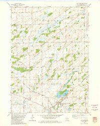
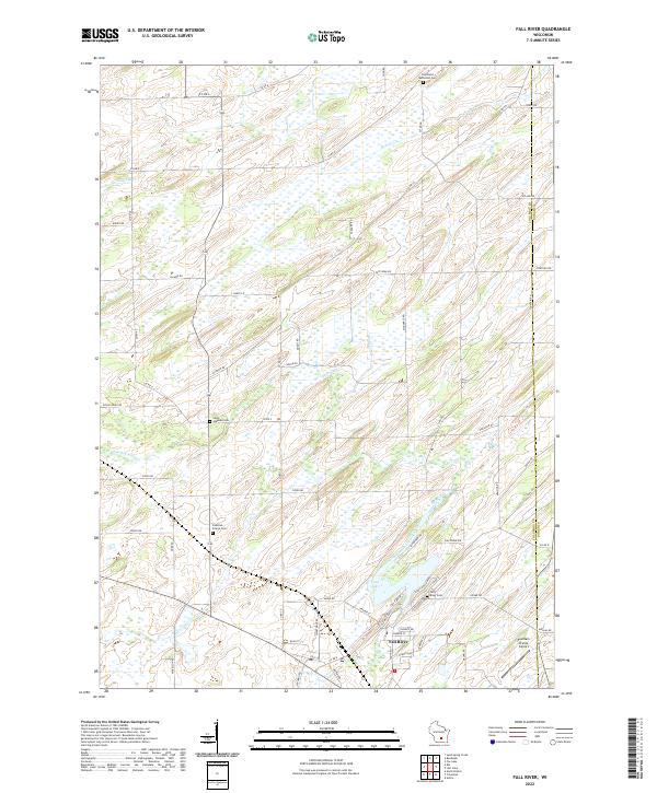
Fall River serves as the primary hub in this agricultural region of southern Wisconsin, situated where the North Branch Crawfish River feeds into Lazy Lake. The landscape is defined by the winding course of the Crawfish River and its various tributaries, including Beaver Cr and Jennings Cr, which carve through the rural countryside. For genealogists and local historians, the area is notably well-marked with burial grounds including Fall River Cem, Fountain Prairie Cem, Saint Stephen Cem, and Courtland Methodist Cem, which help anchor the locations of long-standing family farmsteads.
Find a feature on this map
73 named features on this map. Tap any name to fly to it.
Don’t see what you’re looking for? This feature index may not catch every label — zoom into the map to look around manually.
Map Details
Editions of this 2022 Fall River Map
This is the sole edition of this map. No revisions or reprints were ever made.