2022 Map of Fall River
USGS Topo · Published 2022About this map
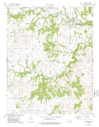
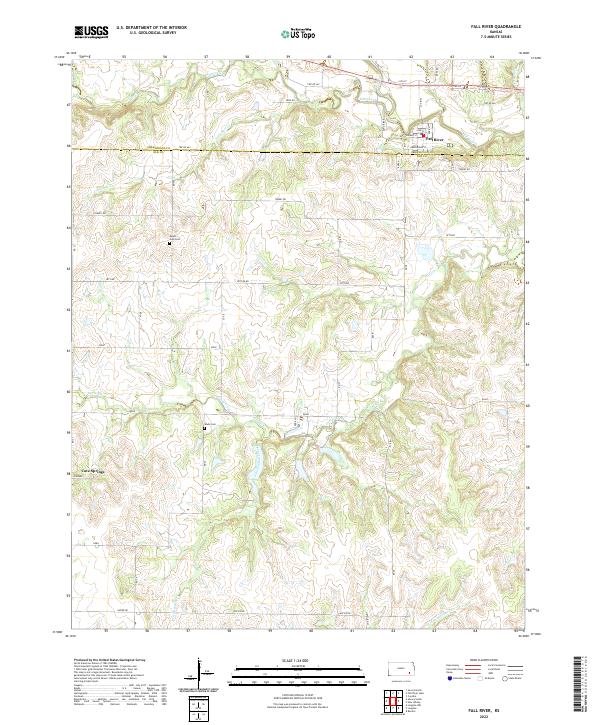
Fall River serves as the primary landmark in this section of the Flint Hills region, winding through the northeast corner where the small community of Fall River is situated. The landscape is defined by a dense network of watercourses, including Salt Creek, Indian Creek, and Little Indian Creek, which have carved the undulating terrain into a series of ridges and drainages. The area is divided by the Greenwood Co Elk Co boundary, marking a transition in local jurisdiction across predominantly rural ranch and farmland.
Find a feature on this map
34 named features on this map. Tap any name to fly to it.
Don’t see what you’re looking for? This feature index may not catch every label — zoom into the map to look around manually.
Map Details
Editions of this 2022 Fall River Map
This is the sole edition of this map. No revisions or reprints were ever made.