2022 Map of Farmville
USGS Topo · Published 2022About this map
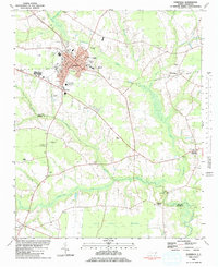
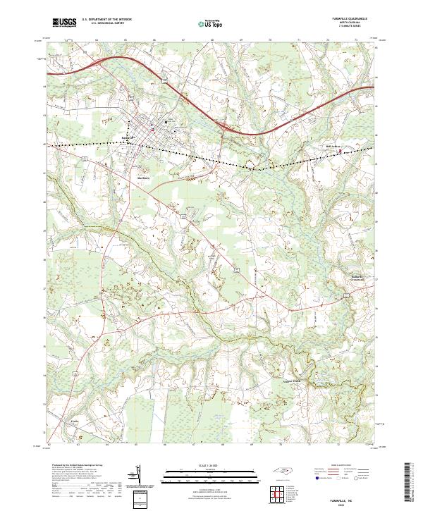
Farmville serves as the primary hub of this eastern North Carolina landscape, where urban streets transition quickly into the agricultural and swampy reaches of the Coastal Plain. The town's grid is anchored by institutions like Forest Hills Cem and Hollywood Cem, while the surrounding countryside is defined by the winding course of Little Contentnea Cr. Smaller settlements such as Marlboro and Bell Arthur dot the region, connected by a network of rural roads that cross through distinct local features like Half Moon Pocosin. The presence of the Pitt Co Greene Co boundary line and sites like Flanagan Field highlight the administrative and local landmarks that shape the identity of this territory. This area is characterized by its numerous watercourses, including Middle Swamp and Sandy Run, which weave through the low-lying terrain to define the local drainage patterns.
Find a feature on this map
100 named features on this map. Tap any name to fly to it.
Don’t see what you’re looking for? This feature index may not catch every label — zoom into the map to look around manually.
Map Details
Editions of this 2022 Farmville Map
This is the sole edition of this map. No revisions or reprints were ever made.