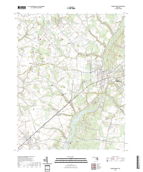
2023 Map of Federalsburg
USGS Topo · Published 2023About this map
Marshyhope Creek defines the local topography as it flows southward through Federalsburg, where the town's industrial and residential grid meets the water at Lake Chambers. This modern survey reveals a landscape where historical land divisions persist across the Caroline and Dorchester County line. Small crossroads settlements like Nichols, Hynson, and Finchville dot the rural agricultural tracts, connected by a dense network of country roads. Genealogists and local historians will find significant detail in the numerous burial sites identified, including the Union Methodist Cem and several smaller family or community plots such as Skinners Cem and Solomon Cem. The map also captures specialized land uses, from the Magennis Farm Airport to the varied drainage systems like Twiford Meadow Ditch and Sullivan Branch that support the region's farming heritage.
Find a feature on this map
121 named features on this map. Tap any name to fly to it.
Don’t see what you’re looking for? This feature index may not catch every label — zoom into the map to look around manually.
Map Details
Editions of this 2023 Federalsburg Map
This is the sole edition of this map. No revisions or reprints were ever made.
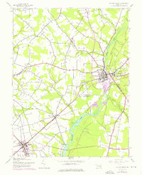
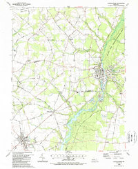
Historical Maps of Hynson Through Time
3 maps found