2024 Map of Fort Belknap Agency
USGS Topo · Published 2024About this map
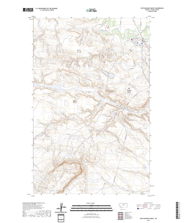
Fort Belknap Agency serves as the focal point for this section of north-central Montana, where the Milk River meanders across the northern reaches of the quadrangle. The map reveals a landscape defined by traditional land divisions and the institutional infrastructure of the community, notably including Aaniiih Nakoda College and the Agency Cem near the riverbank. The local road network, with names like Ereaux Rd and Hockhalter Rd, provides a framework for the rural homesteads scattered throughout the region.
Find a feature on this map
22 named features on this map. Tap any name to fly to it.
Don’t see what you’re looking for? This feature index may not catch every label — zoom into the map to look around manually.
Map Details
Editions of this 2024 Fort Belknap Agency Map
This is the sole edition of this map. No revisions or reprints were ever made.