2024 Map of Gibson
USGS Topo · Published 2024About this map
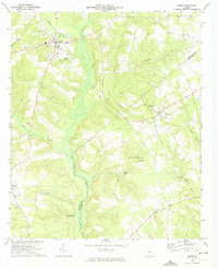
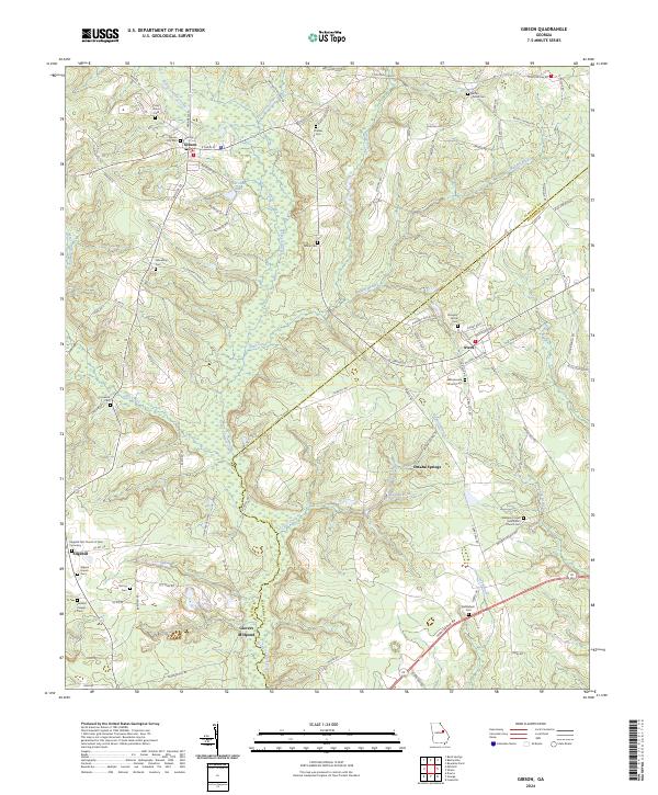
Rocky Comfort Creek flows south through the center of this landscape, separating the town of Gibson from the rural crossroads of Avera and Omaha Springs to the east. This 2024 survey documents the dense network of rural cemeteries and country churches that define the social geography of Glascock and Jefferson counties. Notable landmarks such as Glovers Millpond and the Edgehill First Church of God Cemetery near Edgehill reflect the long-standing agricultural and community roots of the area. The map illustrates how local life remains anchored by old road systems like Glovers Mill Rd and Edgehill Rd, which connect family-named properties and local landmarks across the creek branches. Water features including Beechtree Creek, Deep Creek, and Hadden Pond weave through the terrain, indicating the persistent importance of natural drainage in this pocket of Georgia's coastal plain periphery.
Find a feature on this map
106 named features on this map. Tap any name to fly to it.
Don’t see what you’re looking for? This feature index may not catch every label — zoom into the map to look around manually.
Map Details
Editions of this 2024 Gibson Map
This is the sole edition of this map. No revisions or reprints were ever made.