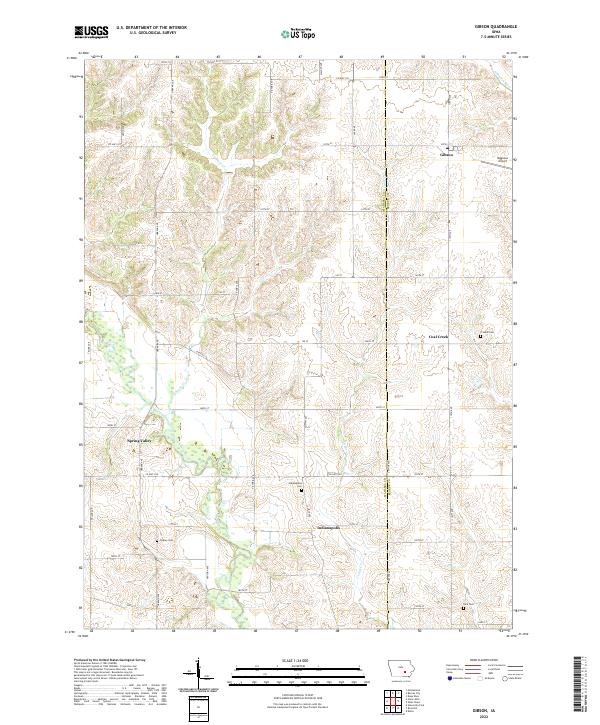
2022 Map of Gibson
USGS Topo · Published 2022About this map
Indianapolis and the surrounding farmland of Keokuk and Mahaska Counties define this rural landscape, situated between the North Skunk River to the south and the S English River at the northern margin. The map documents a classic Iowa agricultural grid, where small settlements like Gibson and Coal Creek served as local hubs. Genealogists will find significant detail in the various burial grounds scattered across the townships, including Friends Cem, Indianapolis Cem, Tinsley Cem, and Rice Cem. The drainage patterns are clearly marked by Pleasant Cr and Cedar Cr, which wind through the terrain. A notable modern addition to the traditional section lines is the Mggenas Airport located just east of Gibson, reflecting how local transportation infrastructure evolved to include small-scale aviation alongside the established county highway system like Co HWY g13 and Co HWY g29.
Find a feature on this map
51 named features on this map. Tap any name to fly to it.
Don’t see what you’re looking for? This feature index may not catch every label — zoom into the map to look around manually.
Map Details
Editions of this 2022 Gibson Map
This is the sole edition of this map. No revisions or reprints were ever made.
Other maps of this area

1954 · Des Moines
USGS Topo · 1:250,000

1956 · Des Moines
USGS Topo · 1:250,000

1957 · Des Moines
USGS Topo · 1:250,000

1965 · Gibson
USGS Topo · 1:24,000

1965 · Rose Hill
USGS Topo · 1:24,000

1965 · What Cheer
USGS Topo · 1:24,000

1965 · Delta
USGS Topo · 1:24,000

1968 · Deep River
USGS Topo · 1:24,000

1968 · University Park
USGS Topo · 1:24,000

1968 · Barnes City
USGS Topo · 1:24,000