Loading...
Loading map...2023 Map of Goldsboro
USGS Topo · Published 2023About this map
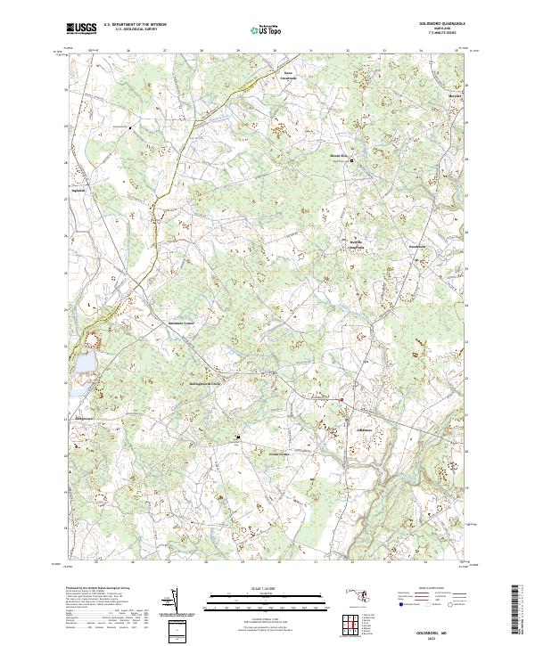
The Choptank River meanders through the southeast corner of this landscape, marking a transition from the agricultural fields of the Upper Delmarva Peninsula to the network of wetlands and ditches that define the regional drainage. The rural character of Caroline County and Queen Anne's County is punctuated by historic crossroads and small settlements like Goldsboro, Henderson, and Marydel on the Delaware state line.
Find a feature on this map
93 named features on this map. Tap any name to fly to it.
Don’t see what you’re looking for? This feature index may not catch every label — zoom into the map to look around manually.
Map Details
Date Portrayed2023
Date Published2023
PublisherU.S. Geological Survey
Map TypeTopographic
Scale1:24000
Physical Dimensions24 x 29 inches
Editions of this 2023 Goldsboro Map
This is the sole edition of this map. No revisions or reprints were ever made.
Historical Maps of Kane Crossroads Through Time
Featured Locations
Source Details
SourceU.S. Geological Survey
CopyrightPublic Domain